Category:1760s maps of Belgium
Countries of Europe: Albania · Armenia‡ · Austria · Azerbaijan‡ · Belgium · Bosnia and Herzegovina · Bulgaria · Cyprus‡ · Denmark · France‡ · Georgia‡ · Germany · Greece · Hungary · Republic of Ireland · Italy · Lithuania · Moldova · Montenegro · Netherlands‡ · Norway · Poland · Portugal‡ · Romania · Russia‡ · Slovenia · Spain‡ · Sweden · Switzerland · Turkey‡ · Ukraine · United Kingdom
Limited recognition: Abkhazia‡
‡: partly located in Europe
Limited recognition: Abkhazia‡
‡: partly located in Europe
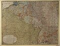
Media in category "1760s maps of Belgium"
The following 6 files are in this category, out of 6 total.
-
 Jeu des cartes géographiques - S. L. Hegrad (13) - Pays Bas catholiques.jpg 1,585 × 2,773; 580 KB
-

-

-

-
 Anonymous.Map1760.JPG 2,069 × 1,587; 1.39 MB
-
 Josephinakarte Opalfene forest, Ternat, Belgium 1767-1774.gif 435 × 498; 96 KB
_-_Pays_Bas_catholiques.jpg)
t%C3%A9_de_Namur,_les_archeveches_de..._-_btv1b10678627g_(1_of_2).jpg)
t%C3%A9_de_Namur,_les_archeveches_de..._-_btv1b10678627g_(2_of_2).jpg)


