Category:1760s maps of Poland
Countries of Europe: Albania · Armenia‡ · Austria · Azerbaijan‡ · Belgium · Bosnia and Herzegovina · Bulgaria · Cyprus‡ · Denmark · France‡ · Georgia‡ · Germany · Greece · Hungary · Republic of Ireland · Italy · Lithuania · Moldova · Montenegro · Netherlands‡ · Norway · Poland · Portugal‡ · Romania · Russia‡ · Slovenia · Spain‡ · Sweden · Switzerland · Turkey‡ · Ukraine · United Kingdom
Limited recognition: Abkhazia‡
‡: partly located in Europe
Limited recognition: Abkhazia‡
‡: partly located in Europe
Media in category "1760s maps of Poland"
The following 6 files are in this category, out of 6 total.
-
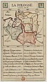 Jeu des cartes géographiques - S. L. Hegrad (15) - La Pologne.jpg 1,579 × 2,764; 633 KB
-

-
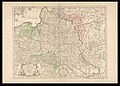
 1769 map of Eastern Europe by Tobias Conrad Lotter.jpg 23,743 × 11,575; 34.34 MB
-
 1769 map of Poland and Russia in Europe by Johann Gottlieb Facius.jpg 11,596 × 7,738; 15.89 MB
-

-
 Guillaume Delisle, La Pologne (FL35077026 2604635).jpg 18,948 × 13,539; 355.81 MB
_-_La_Pologne.jpg)
.jpg)


.jpg)