Category:1760s maps of Turkey
Countries of Asia: Armenia‡ · Azerbaijan‡ · People's Republic of China · Cyprus‡ · Egypt‡ · Georgia‡ · India · Indonesia‡ · Iraq · Japan · Philippines · Russia‡ · Turkey‡
Limited recognition: Abkhazia‡ · Taiwan · State of Palestine
‡: partly located in Asia
Limited recognition: Abkhazia‡ · Taiwan · State of Palestine
‡: partly located in Asia
Countries of Europe: Albania · Armenia‡ · Austria · Azerbaijan‡ · Belgium · Bosnia and Herzegovina · Bulgaria · Cyprus‡ · Denmark · France‡ · Georgia‡ · Germany · Greece · Hungary · Republic of Ireland · Italy · Lithuania · Moldova · Montenegro · Netherlands‡ · Norway · Poland · Portugal‡ · Romania · Russia‡ · Slovenia · Spain‡ · Sweden · Switzerland · Turkey‡ · Ukraine · United Kingdom
Limited recognition: Abkhazia‡
‡: partly located in Europe
Limited recognition: Abkhazia‡
‡: partly located in Europe
Media in category "1760s maps of Turkey"
The following 10 files are in this category, out of 10 total.
-
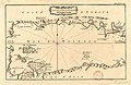 1764 - Carte de la mer de Marmara.jpg 4,592 × 2,984; 1.97 MB
-
 Carte de la Mer Noire; Carte du canal de la Mer Noire. 1764.jpg 2,960 × 3,448; 1.9 MB
-
-

-

-
 1766 manuscript map of Istanbul and the Bosphorus.jpg 7,602 × 8,986; 13.08 MB
-

-
 A Plan of Constantinople, Places Adjacent, and the Canal of the Black Sea. . . 1767.jpg 12,010 × 10,322; 27.69 MB
-
 Bosphorus Thracicus - der Kanal des Schwartzen Meers oder die Meer-Enge bey Constantinopel.tif 8,358 × 12,918; 102.98 MB
-
 Carte de la mer de Marmara - btv1b59642163.jpg 4,592 × 2,984; 1.89 MB


