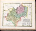
Category:1800s maps of Poland
Countries of Europe: Armenia‡ · Austria · Azerbaijan‡ · Belarus · Belgium · Bosnia and Herzegovina · Bulgaria · Croatia · Cyprus‡ · Czech Republic · Denmark · Estonia · Finland · France‡ · Georgia‡ · Germany · Greece · Hungary · Republic of Ireland · Italy · Latvia · Lithuania · Netherlands‡ · Norway · Poland · Portugal‡ · Romania · Russia‡ · Serbia · Slovenia · Spain‡ · Sweden · Switzerland · Turkey‡ · Ukraine · United Kingdom
Limited recognition: Abkhazia‡
‡: partly located in Europe
Limited recognition: Abkhazia‡
‡: partly located in Europe
Media in category "1800s maps of Poland"
The following 15 files are in this category, out of 15 total.
-
Polen nach den Letzten Friedenshlüssen.jpg 11,237 × 9,429; 24.29 MB
-
1802-Gilly-D2-wycinek.jpg 1,077 × 1,131; 866 KB
-
Swierczynsko mapa Gilly.jpg 785 × 517; 617 KB
-
Szyski Gilly.jpg 1,063 × 1,006; 497 KB
-
Map - Special Collections University of Amsterdam - OTM- HB-KZL 31-09-18.tif 8,088 × 6,934; 160.45 MB
-
Charte vom Königreiche Preussen oder Ost- West- Süd Und Neu- Ost-Preussen.jpg 8,382 × 6,966; 17.88 MB
-
Mappa szczegulna woiewodztwa lubelskiego.jpg 17,384 × 26,101; 101.82 MB
-
Mappa szczegulna woiewodztwa sandomierskiego.jpg 5,796 × 5,124; 9.2 MB
-
1807 map of Poland.jpg 24,598 × 20,800; 83.4 MB
-
Atlas elementaire portatif 1807 (139437645).jpg 10,568 × 13,827; 181.6 MB
-
Grand Duché de Varsovie Place de Modlin 1807.jpg 1,422 × 1,054; 240 KB
-
Robert Wilkinson - Prussia.pdf 13,875 × 11,808; 5.06 MB
-
Prussia 1806 map - DE.svg 712 × 547; 1.89 MB
-
Prussia 1806 map - RU.svg 712 × 547; 1.89 MB
-
Atlas moderne portatif 1804 (84187429).jpg 6,263 × 5,264; 4.05 MB


