Category:1800s maps of Norway
Countries of Europe: Armenia‡ · Austria · Azerbaijan‡ · Belarus · Belgium · Bosnia and Herzegovina · Bulgaria · Croatia · Cyprus‡ · Czech Republic · Denmark · Estonia · Finland · France‡ · Georgia‡ · Germany · Greece · Hungary · Republic of Ireland · Italy · Latvia · Lithuania · Netherlands‡ · Norway · Poland · Portugal‡ · Romania · Russia‡ · Serbia · Slovenia · Spain‡ · Sweden · Switzerland · Turkey‡ · Ukraine · United Kingdom
Limited recognition: Abkhazia‡
‡: partly located in Europe
Limited recognition: Abkhazia‡
‡: partly located in Europe
Subcategories
This category has the following 10 subcategories, out of 10 total.
- 1800 maps of Norway (127 F)
- 1801 maps of Norway (32 F)
- 1802 maps of Norway (34 F)
- 1803 maps of Norway (36 F)
- 1804 maps of Norway (69 F)
- 1805 maps of Norway (117 F)
- 1806 maps of Norway (48 F)
- 1807 maps of Norway (5 F)
- 1808 maps of Norway (19 F)
Media in category "1800s maps of Norway"
The following 4 files are in this category, out of 4 total.
-
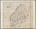 Sweden, Denmark, Norway and Finland, from the best authorities (3046039688).jpg 2,000 × 1,614; 2.83 MB
-
 Utsnitt hallem kartblad 185.png 1,065 × 893; 1.29 MB
-
 Utsnitt hallem kartblad 80.png 1,254 × 843; 1.5 MB
-
 Atlas elementaire portatif 1807 (139436037).jpg 13,719 × 10,531; 178.68 MB
.jpg)


.jpg)