Category:1730s maps of Belgium
Countries of Europe: Armenia‡ · Azerbaijan‡ · Belgium · Bosnia and Herzegovina · Bulgaria · Croatia · Cyprus‡ · Denmark · France‡ · Georgia‡ · Germany · Greece · Hungary · Republic of Ireland · Italy · Lithuania · Netherlands‡ · Norway · Poland · Portugal‡ · Russia‡ · Serbia · Slovenia · Spain‡ · Sweden · Switzerland · Turkey‡ · Ukraine · United Kingdom
Limited recognition: Abkhazia‡
‡: partly located in Europe
Limited recognition: Abkhazia‡
‡: partly located in Europe
Subcategories
This category has only the following subcategory.
1
Media in category "1730s maps of Belgium"
The following 4 files are in this category, out of 4 total.
-
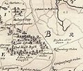 Vrijbos 1735.jpg 967 × 841; 320 KB
-

-
 Les Provinces des Pays-Bas Catholique(s) - btv1b52506994b (1 of 2).jpg 10,931 × 8,230; 17.77 MB
-
 Plan de la Ville et Citadelle D'Anvers.jpg 14,651 × 12,741; 61.11 MB

_-_btv1b52506994b_(1_of_2).jpg)
