Category:1770s maps of Belgium
Countries of Europe: Albania · Armenia‡ · Azerbaijan‡ · Belgium · Cyprus‡ · Denmark · France‡ · Georgia‡ · Germany · Greece · Republic of Ireland · Italy · Lithuania · Moldova · Montenegro · Netherlands‡ · Norway · Poland · Portugal‡ · Romania · Russia‡ · Serbia · Spain‡ · Sweden · Switzerland · Turkey‡ · Ukraine · United Kingdom
Limited recognition: Abkhazia‡
‡: partly located in Europe
Limited recognition: Abkhazia‡
‡: partly located in Europe
Media in category "1770s maps of Belgium"
The following 9 files are in this category, out of 9 total.
-
-
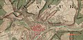 Ferraris Namur avec Berlacomine.jpg 1,449 × 708; 375 KB
-
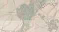 Seigneurie de Esemael.png 826 × 453; 871 KB
-

-

-
 Ferraris Lokeren Kaart.png 4,824 × 3,072; 26.05 MB
-
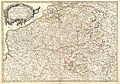
 Ferrariskaart 1777 groot.gif 229 × 373; 38 KB
-
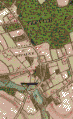
 Huivelde in 1777.png 1,775 × 734; 1.9 MB
-
 Zele in de Atlas van Ferraris.png 1,775 × 734; 1.88 MB


_Robert_de_Vaugondy_G%C3%A9ographe_ord(inaire)_du..._-_btv1b550137444_(079_of_183).jpg)


