Category:1770s maps of Germany
Countries of Europe: Albania · Armenia‡ · Azerbaijan‡ · Belgium · Cyprus‡ · Denmark · France‡ · Georgia‡ · Germany · Greece · Republic of Ireland · Italy · Lithuania · Moldova · Montenegro · Netherlands‡ · Norway · Poland · Portugal‡ · Romania · Russia‡ · Serbia · Spain‡ · Sweden · Switzerland · Turkey‡ · Ukraine · United Kingdom
Limited recognition: Abkhazia‡
‡: partly located in Europe
Limited recognition: Abkhazia‡
‡: partly located in Europe
Federal states of Germany:
Subcategories
This category has the following 17 subcategories, out of 17 total.
Media in category "1770s maps of Germany"
The following 5 files are in this category, out of 5 total.
-
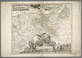
 1771 Rizzi-Zannoni Map of Germany and Poland - Geographicus - GermanyNW-zannoni-1771.jpg 3,500 × 2,450; 3.04 MB
-

-
 Chodowiecki Basedow Tafel 45.jpg 1,984 × 1,940; 424 KB
-
 General-Carte der gesamten Königlichen Preussischen Länder.jpg 11,292 × 7,975; 16.66 MB
-
 Leiningen-1774.png 1,768 × 1,717; 498 KB


