Category:1770s maps of the Netherlands
Countries of Europe: Albania · Armenia‡ · Azerbaijan‡ · Belgium · Cyprus‡ · Denmark · France‡ · Georgia‡ · Germany · Greece · Republic of Ireland · Italy · Lithuania · Moldova · Montenegro · Netherlands‡ · Norway · Poland · Portugal‡ · Romania · Russia‡ · Serbia · Spain‡ · Sweden · Switzerland · Turkey‡ · Ukraine · United Kingdom
Limited recognition: Abkhazia‡
‡: partly located in Europe
Limited recognition: Abkhazia‡
‡: partly located in Europe
Provinces of the Netherlands:
Media in category "1770s maps of the Netherlands"
The following 10 files are in this category, out of 10 total.
-
 De VII Vereenigde Nederlandsche Provinciën COLLBN Port 3 N 87 - sheet 1.tif 8,491 × 6,470; 157.18 MB
-
 De VII Vereenigde Nederlandsche Provinciën COLLBN Port 3 N 87 - sheet 3.tif 8,449 × 6,330; 153.01 MB
-
 Krammer Volkerak 1773.png 665 × 431; 631 KB
-
 Republiek kaart.PNG 1,756 × 1,368; 5.93 MB
-
 De VII Vereenigde Nederlandsche Provinciën COLLBN Port 3 N 87 - sheet 2.tif 6,807 × 6,365; 123.96 MB
-
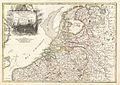 1775 Janvier Map of Holland and Belgium - Geographicus - HollandBelgium-janvier-1775.jpg 3,500 × 2,487; 2.79 MB
-

-

-

-
 Chodowiecki Basedow Tafel 45.jpg 1,984 × 1,940; 424 KB


_Robert_de_Vaugondy_G%C3%A9ographe_ord(inaire)_du..._-_btv1b550137444_(079_of_183).jpg)
