Category:1740s maps of the Netherlands
Countries of Europe: Albania · Armenia‡ · Austria · Azerbaijan‡ · Belarus · Belgium · Bosnia and Herzegovina · Bulgaria · Croatia · Cyprus‡ · Czech Republic · Denmark · France‡ · Georgia‡ · Germany · Greece · Republic of Ireland · Italy · Lithuania · Netherlands‡ · Norway · Poland · Portugal‡ · Romania · Russia‡ · Serbia · Slovenia · Spain‡ · Sweden · Switzerland · Turkey‡ · Ukraine · United Kingdom
Limited recognition: Abkhazia‡
‡: partly located in Europe
Limited recognition: Abkhazia‡
‡: partly located in Europe
Provinces of the Netherlands:
Subcategories
This category has the following 4 subcategories, out of 4 total.
- 1747 maps of the Netherlands (5 F)
Media in category "1740s maps of the Netherlands"
The following 16 files are in this category, out of 16 total.
-
 PaysBas delisle 1743 fragment.jpg 2,666 × 2,042; 5.11 MB
-
 PaysBas delisle 1743.jpg 2,592 × 1,944; 6.75 MB
-
 Peel delisle 1743.jpg 1,925 × 2,197; 3.14 MB
-
 Isaak-Tirion-Hedendaegsche historie MG 0705.tif 4,087 × 3,571; 41.79 MB
-
 Isaak-Tirion-Hedendaegsche historie MG 0704.tif 4,062 × 3,600; 41.88 MB
-
 Isaak-Tirion-Hedendaegsche historie MG 0711.tif 3,977 × 3,509; 39.97 MB
-
 Isaak-Tirion-Hedendaegsche historie MG 0712.tif 5,335 × 1,475; 22.54 MB
-
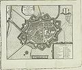 Brielle 1743 Tirion.jpg 2,832 × 2,398; 1.49 MB
-
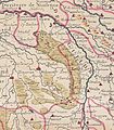
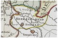 Heerlijkheid anholt 1741.jpg 600 × 394; 205 KB
-
 Heerlijkheid borculo 1741.jpg 1,140 × 920; 831 KB
-
 Heerlijkheid bredevoort 1741.jpg 1,130 × 1,010; 878 KB
-
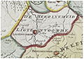 Heerlijkheid lichtenvoorde 1741.jpg 770 × 540; 364 KB
-
 Isaak Tirion.jpg 1,500 × 1,333; 2.4 MB
-
 Kaart met overstromingen in Zuid-Holland, 18e eeuw (5095698563).jpg 2,048 × 800; 415 KB
-

-
 Kwartier van Veluwe.jpg 885 × 768; 389 KB


,_RP-P-AO-19B-22.jpg)

.jpg)