Category:1740s maps of Greece
Countries of Europe: Albania · Armenia‡ · Austria · Azerbaijan‡ · Belarus · Belgium · Bosnia and Herzegovina · Bulgaria · Croatia · Cyprus‡ · Czech Republic · France‡ · Georgia‡ · Germany · Greece · Republic of Ireland · Italy · Lithuania · Netherlands‡ · Norway · Poland · Portugal‡ · Romania · Russia‡ · Serbia · Slovenia · Spain‡ · Sweden · Switzerland · Turkey‡ · Ukraine · United Kingdom
Limited recognition: Abkhazia‡
‡: partly located in Europe
Limited recognition: Abkhazia‡
‡: partly located in Europe
Media in category "1740s maps of Greece"
The following 5 files are in this category, out of 5 total.
-
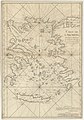
 The Island of Candia the Antient Crete - Pococke Richard - 1745.jpg 1,135 × 1,500; 551 KB
-
-

-
 A Map of Thrace and Greece - Pococke Richard - 1745.jpg 2,000 × 1,491; 1.31 MB
-
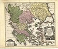 Graecia nova et mare Aegeum (c.1740).jpg 2,400 × 2,028; 1.22 MB

.jpg)
te_Maure,_Cerigo_(et)c._-_dress%C3%A9_sur_les_M%C3%A9moires_de_Mercator,_P._Briet,_Cantelli,_Wischer_(et)c_;_par_son_tres_humble_et_tres_obeiss(an)t..._-_btv1b106786674.jpg)

.jpg)