Category:1740s maps of Russia
Subcategories
This category has the following 4 subcategories, out of 4 total.
- 1747 maps of Russia (3 F)
-
- 1740s maps of Chechnya (1 F)
- 1740s maps of Dagestan (5 F)
Media in category "1740s maps of Russia"
The following 9 files are in this category, out of 9 total.
-
 Мала татарія, Україна - держава козаків.jpg 4,000 × 3,443; 2.39 MB
-
 Таймыр.jpg 1,393 × 937; 373 KB
-
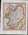 Russia John Cowley map.jpg 479 × 599; 100 KB
-

-

-
 Amsterdam Royal Palace P1070962.JPG 4,000 × 3,000; 4 MB
-
 Barnaulsilver1.jpg 600 × 450; 218 KB
-
 Chitrow - Seekuh, Seebaer und Seeloewe (Ausschnitt aus einer Karte).jpg 2,073 × 1,200; 410 KB
-
 Waxell - Aleuten vor den Schumagininseln (gross).jpg 1,332 × 948; 183 KB


.jpg)


.jpg)
.jpg)