Category:1740s maps of Portugal
Countries of Europe: Albania · Armenia‡ · Austria · Azerbaijan‡ · Belarus · Belgium · Bosnia and Herzegovina · Bulgaria · Croatia · Cyprus‡ · Czech Republic · Denmark · France‡ · Georgia‡ · Germany · Greece · Republic of Ireland · Italy · Lithuania · Netherlands‡ · Norway · Poland · Portugal‡ · Romania · Russia‡ · Serbia · Slovenia · Spain‡ · Sweden · Switzerland · Turkey‡ · Ukraine · United Kingdom
Limited recognition: Abkhazia‡
‡: partly located in Europe
Limited recognition: Abkhazia‡
‡: partly located in Europe
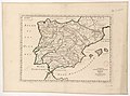
Media in category "1740s maps of Portugal"
The following 8 files are in this category, out of 8 total.
-
 1747 La Feuille Map of Portugal - Geographicus - Portugal-ratelbank-1747.jpg 2,500 × 1,779; 1.71 MB
-
 Antiquorum Hispaniae episcopatuum descriptio - btv1b53063365z.jpg 8,408 × 6,240; 6.17 MB
-

-

-
 El Reyno de España dividido en dos grandes Estados de Aragón y de Castilla.jpg 1,600 × 1,236; 1.84 MB
-
 España y Portugal siglo XVIII.jpg 1,640 × 1,408; 467 KB
-
 Géographie Buffier-carte de l'Espagne-NB.jpg 9,119 × 7,568; 6.83 MB
-
 Géographie Buffier-carte de l'Espagne.jpg 9,119 × 7,568; 8.13 MB


.jpg)


