Category:1780s maps of Portugal
Media in category "1780s maps of Portugal"
The following 19 files are in this category, out of 19 total.
-
 Rigobert-Bonne-Atlas-de-toutes-les-parties-connues-du-globe-terrestre MG 9988.tif 5,259 × 3,563; 53.64 MB
-

-

-

-
 William Faden. Composite Mediterranean. 1785.KB.jpg 885 × 1,253; 358 KB
-
 William Faden. Composite Mediterranean. 1785.KBA.jpg 580 × 621; 134 KB
-
 William Faden. Composite Mediterranean. 1785.KBB.jpg 756 × 663; 164 KB
-
 Detalle mapa Portugal 1786 Bowen.jpg 891 × 582; 232 KB
-

-
-

-

-
 Map of Morocco and Iberia (1783).jpg 640 × 1,348; 477 KB
-
 Planta geografica da barra da cidade do Porto 1789.jpg 1,083 × 757; 528 KB
-
 Planta geográfica da barra da cidade do Porto 1789 (2).jpg 4,630 × 3,272; 3.07 MB
-

-

-
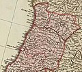
 Royaumes d'Espagne et de Portugal 1780 Rigobert Bonne (detalle noroeste).jpg 1,318 × 1,066; 788 KB
-
 Spain and Portugal, with their general divisions (NYPL b13919861-5207411).jpg 7,980 × 6,604; 45.98 MB

.jpg)
.jpg)


.jpg)

.jpg)

.jpg)


.jpg)
.jpg)