Category:1630s maps of Belgium
Countries of Europe: Armenia‡ · Belgium · Cyprus‡ · Denmark · France‡ · Georgia‡ · Germany · Greece · Republic of Ireland · Italy · Lithuania · Netherlands‡ · Norway · Portugal‡ · Russia‡ · Spain‡ · Sweden · Switzerland · Turkey‡ · Ukraine
‡: partly located in Europe
‡: partly located in Europe
Subcategories
This category has only the following subcategory.
1
Media in category "1630s maps of Belgium"
The following 8 files are in this category, out of 8 total.
-

-
 Print, title-page, frontispiece, map (BM 1922,0714.14).jpg 1,755 × 2,500; 1.34 MB
-
 Comitatuum Hannoniae et Namurci descriptio (8341845441).jpg 800 × 651; 132 KB
-
 Ducatus Limburgum (8341845719).jpg 800 × 644; 123 KB
-
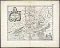
 Karte Herzogtum Limburg 1635.jpg 1,100 × 770; 795 KB
-
 Leodiensis dioecesis (8341845511).jpg 800 × 644; 127 KB
-
 Flandria et Zeelandia Comitatus - btv1b532139691 (1 of 2).jpg 6,595 × 5,150; 8.33 MB
-
 Atlas ou Representation du Monde Universel t. 1. 1633 (109110111).jpg 16,863 × 11,942; 37.34 MB
,_RP-P-AO-1-73-1.jpg)
.jpg)
.jpg)
.jpg)

.jpg)
.jpg)
.jpg)