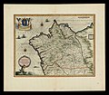
Category:1630s maps of Spain
Countries of Europe: Armenia‡ · Belgium · Cyprus‡ · Denmark · France‡ · Georgia‡ · Germany · Greece · Republic of Ireland · Italy · Lithuania · Netherlands‡ · Norway · Portugal‡ · Russia‡ · Spain‡ · Sweden · Switzerland · Turkey‡ · Ukraine
‡: partly located in Europe
‡: partly located in Europe
Media in category "1630s maps of Spain"
The following 13 files are in this category, out of 13 total.
-
18. Legionis Biscaiae eta Guipuscoae typus”, Mercator (1630).png 1,601 × 1,172; 3.7 MB
-
Maure Alger et Espagne.jpg 1,340 × 976; 331 KB
-
Atlas Van der Hagen-KW1049B12 003-VTRIVSQUE CASTELLAE nova descriptio.jpeg 5,500 × 4,543; 4.66 MB
-
Atlas Van der Hagen-KW1049B12 009-ANDALVZIA continens SEVILLAM et CORDVBAM.jpeg 5,500 × 4,261; 3.13 MB
-
Gallaecia Regnum de Henricus Hondius (1636) (3).jpg 7,563 × 6,494; 9.01 MB
-
Gallaecia, Regnum de Blaeu (2).jpg 7,758 × 6,524; 9.46 MB
-
Gallaecia, Regnum de Blaeu.jpg 7,843 × 6,843; 10.01 MB
-
Map - Special Collections University of Amsterdam - OTM- HB-KZL 32.25.03.tif 6,808 × 5,373; 104.65 MB
-
Map - Special Collections University of Amsterdam - OTM- HB-KZL 32.26.29.tif 6,648 × 5,410; 102.9 MB
-
REo Teixeira1634.JPG 1,353 × 1,776; 810 KB
-
Reyno de Gallicia y de leon no atlas de Christophe Tassin (1633).jpg 2,296 × 1,748; 651 KB
-
Vtriusque Castellae nova descriptio (8357189227).jpg 800 × 662; 134 KB


