Category:1660s maps of Spain
Subcategories
This category has only the following subcategory.
Media in category "1660s maps of Spain"
The following 41 files are in this category, out of 41 total.
-
 Geografía Blaviana, v. 9 (Mapa).jpg 741 × 572; 166 KB
-
 Detalle reino de leon mapa 1665.jpg 1,148 × 1,436; 973 KB
-
 Granada-y-Murcia-Bleau.jpg 1,850 × 1,446; 487 KB
-

-

-
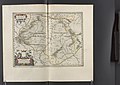
 Gallæcia, Regnvm - Atlas Maior, vol 10, map 4 - Joan Blaeu, 1667 - BL 114.h(star).10.(4).jpg 4,000 × 2,818; 1.42 MB
-

-

-
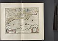
 Andalvzia… - Atlas Maior, vol 10, map 7 - Joan Blaeu, 1667 - BL 114.h(star).10.(7).jpg 4,000 × 2,818; 1.41 MB
-

-
-
-

-

-

-
-

-

-
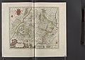
 Catalonia - Atlas Maior, vol 10, map 17 - Joan Blaeu, 1667 - BL 114.h(star).10.(17).jpg 4,000 × 2,818; 1.66 MB
-

-

-
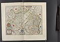
 Navarra Regnvm - Atlas Maior, vol 10, map 20 - Joan Blaeu, 1667 - BL 114.h(star).10.(20).jpg 4,000 × 2,818; 1.63 MB
-
 Insulæ Canariæ - Atlas Maior, vol 10, map 33 - Joan Blaeu, 1667 - BL 114.h(star).10.(33).jpg 4,000 × 2,818; 1.37 MB
-
 Atlas nautique de la Mer Méditerranée - signé G. B. - btv1b5901112h (04 of 10).jpg 5,235 × 3,377; 2.43 MB
-

-
 Hispania Vetus - btv1b53226968x (1 of 2).jpg 2,376 × 1,822; 827 KB
-

-
 Hispaniae nova divisio - btv1b53227052r (1 of 2).jpg 2,692 × 1,740; 796 KB
-
 L'Espagne divisée en ses principaux royaumes - Par P. Du Val - btv1b53226969c (1 of 2).jpg 9,824 × 7,222; 9.22 MB
-

-

-

-
 L'Ile de la Conférence en 1660 (gravure du temps).jpg 1,107 × 775; 334 KB
-
 Le Royaume d Arragon avec ses depe(n)dances - btv1b53227025v (1 of 2).jpg 1,928 × 2,412; 912 KB
-
 Map - Special Collections University of Amsterdam - OTM- HB-KZL 32.22.30.tif 6,734 × 5,445; 104.9 MB
-
 Map - Special Collections University of Amsterdam - OTM- HB-KZL 32.22.35.tif 7,228 × 6,100; 126.15 MB
-
 Map - Special Collections University of Amsterdam - OTM- HB-KZL 32.23.08.tif 6,976 × 5,452; 108.81 MB
-
 Pars orientalis antiquae Hispaniae - btv1b53227029n (1 of 2).jpg 1,852 × 2,318; 917 KB
-

-
 Vegueries 1660.jpg 7,488 × 5,664; 6.48 MB
-

.jpg)


.10.(2).jpg)
.10.(3).jpg)
.10.(4).jpg)
.10.(5).jpg)
.10.(6).jpg)
.10.(7).jpg)
.10.(8).jpg)
.10.(9).jpg)
.10.(10).jpg)
.10.(11).jpg)
.10.(12).jpg)
.10.(13).jpg)
.10.(14).jpg)
.10.(15).jpg)
.10.(16).jpg)
.10.(17).jpg)
.10.(18).jpg)
.10.(19).jpg)
.10.(20).jpg)
.10.(33).jpg)
.jpg)

.jpg)

.jpg)
.jpg)
.jpg)
t%C3%A9s,_seign(eu)ries..._-_par_le_Sr_Sanson_d%27Abb(evil)le..._-_btv1b530570452.jpg)
_d%27Estat_%26c._Par_N._Sanson_le_fils_Geographe_du_Roy_-_btv1b550137605_(069_of_114).jpg)
.jpg)
dances_-_btv1b53227025v_(1_of_2).jpg)
.jpg)
.10.(1).jpg)

