Home
Random
Nearby
Log in
Settings
Donate Now
If this site has been useful to you, please give today.
About Wikimedia Commons
Disclaimers
Search
Category
:
1660s maps of Greece
Language
Watch
Edit
Countries of Europe
:
Azerbaijan
‡
·
Belgium
·
Bulgaria
·
Croatia
·
Denmark
·
France
‡
·
Germany
·
Greece
·
Hungary
·
Ireland
·
Italy
·
Lithuania
·
Netherlands
‡
·
Norway
·
Poland
·
Portugal
‡
·
Romania
·
Russia
‡
·
Serbia
·
Spain
‡
·
Switzerland
·
Turkey
‡
·
Ukraine
Nations of the United Kingdom
:
England
·
Wales
‡
:
partly located in Europe
17th-century maps of Greece
:
◀
·
1600s
·
1610s
·
1620s
·
1630s
·
1640s
·
1650s
·
1660s
·
1670s
·
1680s
·
1690s
·
▶
Media in category "1660s maps of Greece"
The following 4 files are in this category, out of 4 total.
Johann Lauremberg, Maris Ægæi quod hodie Archipelago nuncupatur, Pars Septentrionalis (FL35072668 2533502).jpg
15,158 × 13,722; 273.91 MB
L'Europe Dediée a Monseigneur Monseigneur le Tellier Secret(aire) d'Estat &c. Par N. Sanson le fils Geographe du Roy - btv1b550137605 (084 of 114).jpg
5,242 × 4,053; 2.97 MB
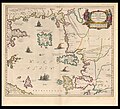
Macedonia, Epirvs et Achaia - Atlas Maior, vol 2, map 35 - Joan Blaeu, 1667 - BL 114.h(star).2.(35).jpg
4,000 × 3,497; 2.32 MB
Achaia seu Hellas - btv1b53214044w (1 of 2).jpg
3,050 × 2,694; 1.53 MB