Category:1640s maps of the world
| 17th-century maps of the world: ← 1600s 1610s 1620s 1630s 1640s 1650s 1660s 1670s 1680s 1690s → |
English: This category is supposed to hold world maps created in the 1640s.
Subcategories
This category has the following 2 subcategories, out of 2 total.
A
B
- Burgerzaal map (24 F)
Media in category "1640s maps of the world"
The following 20 files are in this category, out of 20 total.
-
 1643 Portolan chart of the World by Giovane Oliva.png 8,750 × 6,540; 115.49 MB
-
 1646 New Speed Kaerius.jpg 1,687 × 1,224; 1.88 MB
-
 Map of the Inhabited Quarter.png 1,440 × 824; 1.6 MB
-
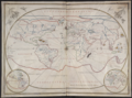
 Ca. 1648 map of the world by Matthäus Merian.tif 6,252 × 4,674; 83.63 MB
-
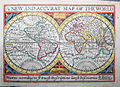
 A new and accurat map of the world (8642021329).jpg 5,227 × 3,776; 21.23 MB
-
-
 Atlas composite - cartes des provinces de France - btv1b531039038 (009 of 120).jpg 6,778 × 4,973; 8.07 MB
-
 De Grondt en Vloer vande Groote Burger Sael.jpg 17,972 × 10,455; 57.1 MB
-
 Fotothek df tg 0007189 Geographie ^ Karte.jpg 6,002 × 4,284; 13.03 MB
-
 Globes - Societatis Missiones Indicae (cropped).jpg 3,360 × 2,563; 2.79 MB
-
 Great Burgerzaal Map and Celestial Map.jpg 13,520 × 3,961; 19.4 MB
-
 Great Burgerzaal Map.png 2,321 × 1,200; 7.63 MB
-
 Hendrik Hondius, Nova Totius Terrarum orbis Geographica ac Hydrographica Tabula 1641.jpg 4,800 × 3,400; 24.62 MB
-
 Nova Totius Terrarum orbis Geographica ac Hydrographica Tabula - no-nb krt 00678.jpg 8,867 × 6,354; 22.59 MB
-
-

-
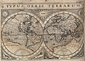
 Nova et accuratissima totius terrarum orbis tabula (NYPL b13963883-psnypl map 233).jpg 4,708 × 3,672; 4.43 MB
-

-
 Societatis Missiones Indicae.jpg 4,529 × 7,451; 6.26 MB
-
 Wilhelm Blaeu - Map of the World 1649.jpg 4,800 × 3,678; 9.57 MB


.jpg)

.jpg)


.jpg)


.jpg)
,_RP-P-AO-21-13-15.jpg)

