Category:1670s maps of the Atlantic Ocean
Media in category "1670s maps of the Atlantic Ocean"
The following 14 files are in this category, out of 14 total.
-
 Nova Europa; Pascaarte de Hugo Allardt (1670).jpg 8,036 × 6,498; 7.77 MB
-

-

-

-

-
 Pascaarte van alle de Zee-custen van Europa de Willem, Pieter e Joan Blaeu (1677).jpg 10,742 × 8,668; 75.29 MB
-
-
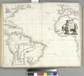
 A general chart of the West India's RMG F8076.tiff 4,701 × 3,844; 51.7 MB
-

-
 Pascaart van Europa (NYPL b13908778-1619021).jpg 5,418 × 4,512; 6.59 MB
-

-

-

-

.jpg)

.jpg)
.jpg)
.jpg)

.jpg)
.jpg)

