Category:1690s maps of Ukraine
Countries of Europe: Armenia‡ · Austria · Azerbaijan‡ · Belarus · Belgium · Bulgaria · Cyprus‡ · Denmark · France‡ · Georgia‡ · Germany · Greece · Hungary · Republic of Ireland · Italy · Lithuania · Montenegro · Netherlands‡ · Norway · Poland · Portugal‡ · Russia‡ · Spain‡ · Sweden · Switzerland · Turkey‡ · Ukraine
‡: partly located in Europe
‡: partly located in Europe
Media in category "1690s maps of Ukraine"
The following 15 files are in this category, out of 15 total.
-
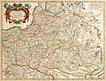 Tabula nova totius regni Poloniae Amsterdam, Visscher Nicolas (Amsterdam, 1690).jpg 5,531 × 4,263; 5.36 MB
-
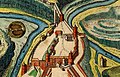 Kamianets-Podilskyi map 1691 (fragment).jpg 1,141 × 735; 508 KB
-
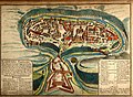 Kamianets-Podilskyi map 1691.jpg 2,296 × 1,680; 1.58 MB
-
 Atlante Veneto Volume 1 152.jpg 6,596 × 9,808; 7.91 MB
-
 Atlante Veneto Volume 2 097.jpg 6,985 × 10,592; 7.04 MB
-
 Atlante Veneto Volume 2 098.jpg 7,033 × 10,592; 7.79 MB
-
 Atlante Veneto Volume 2 099.jpg 7,050 × 10,584; 7.75 MB
-
 Atlante Veneto Volume 2 102.jpg 7,039 × 10,616; 8.3 MB
-
 Untitled globe gore depicting Southern Russia, Ukraine, the Caucasus and the Levante.jpg 7,591 × 11,168; 16.77 MB
-
 1692 – “La Russie blanche ou Moscovie Alexis-Hubert Jaillot (París).jpg 1,664 × 1,962; 1.06 MB
-
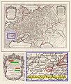
 Estats De La Couronne De Pologne.jpg 1,593 × 1,300; 3.07 MB
-
 N. Mer Noire, tirée de l'original turc, fait á Kafa. 1697.jpg 5,319 × 4,011; 3.47 MB
-
 Карта Чёрного моря, 1697 год.jpg 1,599 × 1,249; 639 KB
-

-
 Mengden 1699.jpg 978 × 880; 267 KB
.jpg)
.jpg)


.jpg)


_(1699).jpg)
