Category:1680s maps of Ukraine
Countries of Europe: Armenia‡ · Austria · Azerbaijan‡ · Belgium · Bosnia and Herzegovina · Bulgaria · Croatia · Cyprus‡ · Denmark · France‡ · Georgia‡ · Germany · Greece · Hungary · Republic of Ireland · Italy · Lithuania · Montenegro · Netherlands‡ · Norway · Poland · Portugal‡ · Romania · Russia‡ · Serbia · Slovakia · Slovenia · Spain‡ · Sweden · Switzerland · Turkey‡ · Ukraine
‡: partly located in Europe
‡: partly located in Europe
Subcategories
This category has the following 3 subcategories, out of 3 total.
- 1680 maps of Ukraine (2 F)
- 1681 maps of Ukraine (2 F)
- 1685 maps of Ukraine (1 F)
Media in category "1680s maps of Ukraine"
The following 5 files are in this category, out of 5 total.
-
 Georgia. Tartaria d'Europa - Tatars in Europe (1684) (cropped).jpg 3,114 × 2,597; 2.81 MB
-
 Tartaria d'Europa - Tatars in Europe (1684).jpg 6,763 × 5,303; 12.31 MB
-
 Південно-Східна Європа 1684.JPG 1,890 × 1,520; 852 KB
-
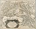
 1684 map of Little Tartary by Giacomo Cantelli da Vignola.jpg 13,738 × 10,971; 25.81 MB
-
 Tartaria D Europa ouro Piccola Tartaria.jpg 2,500 × 1,985; 2.89 MB
_(cropped).jpg)
.jpg)


