Category:1680s maps of Germany
Countries of Europe: Armenia‡ · Austria · Azerbaijan‡ · Belgium · Bosnia and Herzegovina · Bulgaria · Croatia · Cyprus‡ · Denmark · France‡ · Georgia‡ · Germany · Greece · Hungary · Republic of Ireland · Italy · Lithuania · Montenegro · Netherlands‡ · Norway · Poland · Portugal‡ · Romania · Russia‡ · Serbia · Slovakia · Slovenia · Spain‡ · Sweden · Switzerland · Turkey‡ · Ukraine
‡: partly located in Europe
‡: partly located in Europe
Subcategories
This category has the following 23 subcategories, out of 23 total.
- 1680 maps of Germany (7 F)
- 1681 maps of Germany (1 F)
- 1683 maps of Germany (1 F)
- 1688 maps of Germany (1 F)
B
- 1680s maps of Berlin (2 F)
- 1680s maps of Brandenburg (2 F)
- 1680s maps of Bremen (state) (1 F)
H
- 1680s maps of Hesse (7 F)
L
M
N
R
S
- 1680s maps of Saarland (1 F)
- 1680s maps of Saxony (1 F)
Media in category "1680s maps of Germany"
The following 11 files are in this category, out of 11 total.
-
-
 New systeme of the mathematicks. map of germany.tif 6,259 × 5,112; 60.32 MB
-

-

-
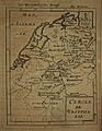
 Germany's ten circles, 1685.jpg 642 × 900; 410 KB
-
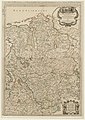
 Map of ancient Germany, 1683.jpg 675 × 1,035; 193 KB
-
 Map of Germany, 1685.jpg 662 × 900; 466 KB
-
 Map of Upper Saxony, 1685.jpg 674 × 900; 455 KB
-
 Map of Westphalia, 1685.jpg 695 × 900; 454 KB
-

-


.jpg)
.jpg)