Category:1640s maps of Germany
Federal states of Germany:
Subcategories
This category has the following 11 subcategories, out of 11 total.
B
- 1640s maps of Brandenburg (1 F)
- 1640s maps of Bremen (state) (3 F)
H
- 1640s maps of Hamburg (4 F)
- 1640s maps of Hesse (11 F)
L
- 1640s maps of Lower Saxony (12 F)
M
N
R
S
Media in category "1640s maps of Germany"
The following 9 files are in this category, out of 9 total.
-
 Circulus Westphalicus, sive Germaniae inferioris (8343030088).jpg 800 × 662; 146 KB
-

-

-
 Print, map (BM 1880,0710.489).jpg 2,500 × 1,673; 1.04 MB
-
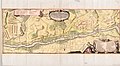
 Allemagne - btv1b8446543h (1 of 2).jpg 5,856 × 5,448; 4.31 MB
-
 Dingolfing schwedisches Feldlager Karte 1648 koloriert.jpg 13,815 × 7,596; 45.24 MB
-
 Dingolfing schwedisches Feldlager Karte 1648 nachkoloriert.jpg 1,499 × 630; 313 KB
-
 Dingolfing schwedisches Feldlager Karte 1648.jpg 13,815 × 7,596; 80.71 MB
-
 Ansicht von Schloss und Stadt Homburg, um 1640 (cropped).jpg 3,864 × 5,376; 3.83 MB
.jpg)
.jpg)

.jpg)
.jpg)


.jpg)