Category:1694 maps
| ← · 1690 · 1691 · 1692 · 1693 · 1694 · 1695 · 1696 · 1697 · 1698 · 1699 · → |
Deutsch: Karten mit Bezug zum Jahr 1694
English: Maps related to the year 1694
Español: Mapas relativos al año 1694
Français : Cartes concernant l’an 1694
Русский: Карты 1694 года
Subcategories
This category has the following 3 subcategories, out of 3 total.
Media in category "1694 maps"
The following 20 files are in this category, out of 20 total.
-
 1694 - Johann Baptist Homann "Schlarraffenlandes" (Accurata Utopiæ Tabula).jpg 6,873 × 5,720; 8.68 MB
-
 Amerique septentrionale divisée en ses principales parties. NYPL434960.tiff 5,004 × 4,635; 66.37 MB
-
 Amerique septentrionale divisée en ses principales parties. NYPL489844.tiff 5,403 × 4,624; 43.14 MB
-
 Amerique septentrionale divisée en ses principales parties. NYPL489847.tiff 4,280 × 5,115; 62.64 MB
-
 Carte des Pyrénées au XVIIeme siècle.jpg 6,286 × 4,048; 10.61 MB
-
 Carte Jèrri 1694.jpg 3,292 × 2,670; 8.4 MB
-

-
 Fotothek df tg 0002917 Architektur ^ Festungsbau ^ Approche.jpg 635 × 820; 254 KB
-

-
 Illyricum occidentis 1694.jpg 4,019 × 3,359; 1.58 MB
-
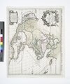
 Johannes II van Keulen (1704-1755), Archipelagusche Eylanden (FL13730701 3368616).jpg 10,319 × 8,696; 120.96 MB
-
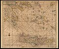 Johannes van Keulen (1654-1715), Archipelagusche Eylanden (FL35072752 2534522).jpg 15,159 × 12,751; 280.82 MB
-

-

-

-
 Nicolas Sanson, Illyricum Orientis (FL36554669 2525120).jpg 13,826 × 10,344; 195.68 MB
-
 Ost-See, XVII.jpg 896 × 800; 302 KB
-

-
 Romeyn de Hooghe, Carte nouvelle de la mer Mediterranee (FL147398811 2619625).jpg 9,044 × 3,868; 41.42 MB
-
 Sébastien Pontault de Beaulieu, Candie (FL39695559 2369957).jpg 14,447 × 4,114; 85.96 MB
.jpg)


.jpg)

,_Archipelagusche_Eylanden_(FL13730701_3368616).jpg)
,_Archipelagusche_Eylanden_(FL35072752_2534522).jpg)
,_Haaven-Kaart_Van_Eenige_Voornaamste_Haavens_leggende_in_de_Middel-Landsche_Zee_En_Archipelago_(FL13732043_3373778).jpg)
,_Pas-kaart_van_%27t_Oosterste_deel_van_de_Middelantsche_Zee_Vervattende_de_Zee-Kusten_(FL13732088_3373887).jpg)
.jpg)
.jpg)

.jpg)
.jpg)
.jpg)