Category:1697 maps
| ← · 1690 · 1691 · 1692 · 1693 · 1694 · 1695 · 1696 · 1697 · 1698 · 1699 · → |
Deutsch: Karten mit Bezug zum Jahr 1697
English: Maps related to the year 1697
Español: Mapas relativos al año 1697
Français : Cartes concernant l’an 1697
Русский: Карты 1697 года
Subcategories
This category has the following 3 subcategories, out of 3 total.
E
N
Media in category "1697 maps"
The following 26 files are in this category, out of 26 total.
-
 (Aihun, Luosha, Taiwan, Nei Menggu tu) LOC gm71005078.jpg 12,280 × 6,714; 13.25 MB
-
-
 1697 Pufendorf View of Krakow (Cracow), Poland - Geographicus - Krakow-pufendorf-1655.jpg 6,000 × 3,299; 7.42 MB
-
 Adam Pérelle, Delineatio Rigae Urbis Riga et Obsi (FL39695604 2369986).jpg 14,208 × 8,876; 190.22 MB
-

-
 Bourg, Chateau et Iardins de Fontaine-bleau - Nicolas de Fer.jpg 9,201 × 5,415; 7.32 MB
-
 Canada orientale nell America Settentrionale (8643348038).jpg 799 × 500; 103 KB
-

-
 D. Lovisa, Turcici Imperii Descriptio (FL13729630 2516019).jpg 2,221 × 1,552; 4.46 MB
-
 Eppinger Linie Lomersheim.jpg 625 × 901; 111 KB
-
 Imperii sinarum nova descriptio. LOC 2006629364.jpg 5,352 × 4,776; 4.12 MB
-
 Imperii sinarum nova descriptio. LOC 2006629364.tif 5,352 × 4,776; 73.13 MB
-
 Isola Cuba (8643348138).jpg 800 × 665; 92 KB
-
 Isola e citta di Cartagena nell America (8643347986).jpg 662 × 800; 121 KB
-
 Isole Antili, la Cuba, la Spagnuola (8642247537).jpg 800 × 658; 120 KB
-

-
 Isole della Dalmatia divise nesuoi contadi parte occidentale 1697.jpg 8,503 × 5,982; 8.47 MB
-

-
 La Spagnuola (8642247571).jpg 660 × 800; 121 KB
-
 Mexico and Central America (8642247407).jpg 670 × 800; 114 KB
-
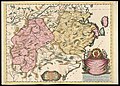
 Patria dell Friuli coll'Isole che gli dipendono 1697.jpg 8,504 × 5,878; 8.15 MB
-
 Samuel Wesley, A new Mapp of the Holy Land (FL45582939 3925842).jpg 3,831 × 3,498; 3.35 MB
-

-
 Vincenzo Coronelli, Chekiang, e Kiangsi (FL46961890 2469602).jpg 15,810 × 11,351; 256.86 MB
-

-
 Vincenzo Coronelli, Xansi, e Xensi (FL46961923 2469529).jpg 15,653 × 11,474; 246.81 MB
_LOC_gm71005078.jpg)
,_Poland_-_Geographicus_-_Krakow-pufendorf-1655_(cropped,_1to1_portrait).jpg)
,_Poland_-_Geographicus_-_Krakow-pufendorf-1655.jpg)
.jpg)
.jpg)

.jpg)
.jpg)


.jpg)
.jpg)
.jpg)

.jpg)
.jpg)
.jpg)

.jpg)
.jpg)
.jpg)
.jpg)
.jpg)