Category:16th-century maps of Hesse
Federal states of Germany:
Subcategories
This category has the following 9 subcategories, out of 9 total.
#
- 1560s maps of Hesse (4 F)
- 1570s maps of Hesse (10 F)
- 1580s maps of Hesse (6 F)
- 1590s maps of Hesse (4 F)
1
Media in category "16th-century maps of Hesse"
The following 14 files are in this category, out of 14 total.
-
 Atlas type Lafréri - btv1b52511601q (072 of 226).jpg 5,440 × 4,343; 3.12 MB
-
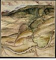
 Grenze bei Neukirchen.jpg 2,015 × 3,000; 830 KB
-
 Karte der Gemarkung Freienseen.jpg 5,806 × 4,839; 34.97 MB
-

-
 Karte der Seulingsees.tif 4,623 × 3,578; 47.35 MB
-
 Karte des Gebiets zwischen Main und Nidda.jpg 4,112 × 4,960; 25.3 MB
-
-
 Karte des Kaufunger Waldes von der Losse bis zur Werra.jpg 1,983 × 1,513; 509 KB
-
 Karte des Mains.jpg 12,771 × 4,629; 33.21 MB
-
 Karte des Werratals und der Umgebung zwischen Witzenhausen und Hedemünden.jpg 3,000 × 2,946; 1.62 MB
-
 Karte eines Waldstücks bei Klein-Zimmern.jpg 4,961 × 3,955; 27.47 MB
-
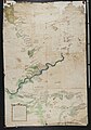
 Karte zu den Grenzstreitigkeiten zwischen den Ämtern Sternberg und Schaumburg.tif 10,858 × 3,802; 118.39 MB
-
-

.jpg)


.jpg)