Category:19th-century maps of Hesse
Federal states of Germany:
Subcategories
This category has the following 12 subcategories, out of 12 total.
#
- 1800s maps of Hesse (19 F)
- 1830s maps of Hesse (8 F)
- 1840s maps of Hesse (3 F)
- 1860s maps of Hesse (6 F)
- 1890s maps of Hesse (6 F)
1
Media in category "19th-century maps of Hesse"
The following 16 files are in this category, out of 16 total.
-
 Meyers b8 s0467a.jpg 1,542 × 2,048; 957 KB
-
 Ausschnitt von Composite 507. Frankfurt a. M.(Germany)5820507c.jpg 1,962 × 1,308; 3.07 MB
-
 Fischbach 1819.jpg 408 × 408; 285 KB
-
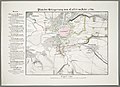
 Gefecht bei Corbach am 10. Juli 1760.jpg 4,396 × 3,331; 3.71 MB
-
 Neue Karte von Chur-Hessen (1788).jpg 1,630 × 1,436; 2.22 MB
-
 Operations Karte für die 1te Hälfte des Feldzuges von 1760, bis Ende Juli.jpg 9,101 × 6,945; 10.79 MB
-
-

-
 Otzberg 1832-1850.jpg 1,297 × 1,182; 639 KB
-
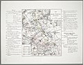
 Plan der Belagerung von Cassel im Jahr 1762.jpg 6,654 × 4,843; 8.45 MB
-
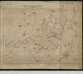
 Plan der Schlacht bei Wilhelmsthal den 24ten Iuni (Juni) 1762.jpg 6,938 × 5,352; 9.58 MB
-
 Situationsplan von Koblenz und Ehrenbreitstein, Mitte des 19. Jahrhunderts.jpg 3,984 × 3,536; 3.09 MB
-
 Wandkarte der Provinz Oberhessen.jpg 2,556 × 3,000; 1.29 MB
-
 Wandkarte der Provinz Starkenburg und Rheinhessen.jpg 3,000 × 2,841; 1.33 MB
-

-

5820507c.jpg)


.jpg)


_1762.jpg)


_-_entworfen_von_F._Handtke_-_btv1b532099099.jpg)