Category:19th-century maps of Berlin
Federal states of Germany:
Subcategories
This category has the following 10 subcategories, out of 10 total.
- 1820s maps of Berlin (6 F)
- 1860s maps of Berlin (11 F)
- 1870s maps of Berlin (26 F)
Media in category "19th-century maps of Berlin"
The following 13 files are in this category, out of 13 total.
-
 Brockhaus and Efron Encyclopedic Dictionary b83 255-0.jpg 2,800 × 2,127; 2.69 MB
-
 Iconographic Encyclopedia of Science, Literature and Art 204.jpg 2,820 × 2,289; 1.38 MB
-
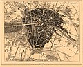
 Grundriss von Berlin 02 (cropped).jpg 385 × 522; 104 KB
-
 Grundriss von Berlin 02.jpg 2,965 × 2,171; 1.88 MB
-
 Grundriss von Berlin 03.jpg 1,462 × 1,946; 877 KB
-
 Grundriss von Berlin 04.jpg 2,808 × 1,946; 1.42 MB
-
 Grundriss von Berlin 05.jpg 2,831 × 1,945; 1.42 MB
-
 Grundriss von Berlin 06.jpg 2,832 × 1,959; 1.42 MB
-
 Grundriss von Berlin 07.jpg 2,831 × 1,945; 1.42 MB
-
 Grundriss von Berlin 08.jpg 2,833 × 1,952; 1.43 MB
-
 Grundriss von Berlin 09.jpg 2,814 × 1,952; 1.39 MB
-
 Grundriss von Berlin 10.jpg 2,832 × 1,966; 1.44 MB
-
 Grundriss von Berlin 11.jpg 2,823 × 1,959; 1.34 MB


.jpg)


