Category:19th-century maps of Schleswig-Holstein
Federal states of Germany:
Subcategories
This category has the following 11 subcategories, out of 11 total.
- 1860s maps of Schleswig-Holstein (13 F)
Media in category "19th-century maps of Schleswig-Holstein"
The following 38 files are in this category, out of 38 total.
-
-
 Folkesprogene i Hertugdømmet Slesvig (Higher Resolution Version).png 3,456 × 5,184; 25.97 MB
-
 Folkesprogene i Hertugdømmet Slesvig (Map Only Version).png 2,826 × 3,888; 20.3 MB
-
 Pincerno - Niederelbe 1860.jpg 1,191 × 842; 315 KB
-
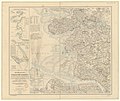
 Daenemark mit Schleswig, Holstein und Lauenburg, auch Südl. Theil v. Schweden.jpg 5,586 × 4,527; 7.53 MB
-
 EB9 Denmark-1878.png 2,811 × 3,870; 11 MB
-
 EB9 Denmark.png 2,821 × 4,000; 16.19 MB
-
 Die Gartenlaube (1887) b 427.jpg 1,092 × 681; 193 KB
-
 Karte der Umgebung von Kiel.jpg 362 × 569; 96 KB
-
-

-
-
 443 of 'Alt-Kiel in Wort und Bild ... Mit ... Abbildungen und Plänen' (11249630593).jpg 3,660 × 3,031; 2.01 MB
-

-
 8bTondern1864.jpg 2,858 × 2,198; 7.66 MB
-

-
-
 Meyers b2 s0141 b1.png 477 × 778; 140 KB
-
 Bahnen in SH aus Bahnkarte Deutschland 1899.png 900 × 1,200; 2.21 MB
-
 Charte vom Niedersächsischen Kreise, 1804.jpg 3,226 × 2,939; 9.12 MB
-

-
 Die Gartenlaube (1880) b 592.jpg 1,372 × 982; 555 KB
-
 FlensborgBybefæstning.png 704 × 1,656; 735 KB
-
 Folkesprogene i Hertugdømmet Slesvig.png 865 × 1,341; 1.91 MB
-
 Fürstentum Lübeck.jpg 1,080 × 1,438; 620 KB
-
 Helgoland karte.jpg 367 × 299; 54 KB
-

-

-
 Historische Karte von Dithmarschen, Eiderstedt...Geerz Franz btv1b53022708r.jpg 10,813 × 9,069; 19.96 MB
-
 Historische Karte von Dithmarschen, Eiderstedt...Geerz Franz btv1b53022708r.tif 10,813 × 9,069; 561.19 MB
-
 Marschbahn aus Bahnkarte Deutschland 1849.png 308 × 510; 314 KB
-
 Marschbahn aus Bahnkarte Deutschland 1861.png 250 × 413; 216 KB
-
 Marschbahn aus Bahnkarte Deutschland 1899.png 500 × 825; 878 KB
-
 Meyers b14 s0520a.jpg 800 × 1,039; 372 KB
-
 MTBL1416See-Sand1880.jpg 2,362 × 2,850; 7.89 MB
-
 Schleswig 1871.JPG 1,400 × 1,869; 1.28 MB
-
 Seesand map 1895.png 597 × 400; 204 KB
-
 Situationskort-Flensborg.png 1,235 × 825; 201 KB
_..._Med_253_Illustrationer_i_Tr%C3%A6snit%27_(11242360673).jpg)
.png)
.png)


_b_427.jpg)

_..._Med_253_Illustrationer_i_Tr%C3%A6snit%27_(11076210486).jpg)
.jpg)
_..._Med_253_Illustrationer_i_Tr%C3%A6snit%27_(11083060096).jpg)
.jpg)
.jpg)

.jpg)


_b_592.jpg)


.jpg)


