Category:1850s maps of Berlin
|
Federal states of Germany: |
Subcategories
This category has the following 2 subcategories, out of 2 total.
- 1857 maps of Berlin (2 F)
- 1859 maps of Berlin (1 F)
Media in category "1850s maps of Berlin"
The following 6 files are in this category, out of 6 total.
-
 Boehm Umgebungskarte von Berlin 1851.jpg 9,500 × 6,462; 24.59 MB
-
 Boehm Umgebungskarte von Berlin 1851; Berlin-Reinickendorf (cropped).jpg 1,768 × 1,026; 993 KB
-
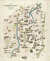
 Delius Plan von Berlin 1850.jpg 2,772 × 2,042; 2.47 MB
-
 Plan von Berlin mit dem Weichbilde und der Umgegend bis Charlottenburg 1855.jpg 7,379 × 5,577; 22.59 MB
-
 Stadtplanberlin1855.jpg 3,000 × 2,422; 2.52 MB
-
 Plan Monumental von Berlin 1856.jpg 3,648 × 4,484; 4.73 MB

.jpg)


