Category:1700s maps of Australia
States of Australia:
Internal territories of Australia:
External territories of Australia:
Internal territories of Australia:
External territories of Australia:
Media in category "1700s maps of Australia"
The following 6 files are in this category, out of 6 total.
-
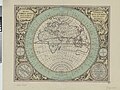
 B26055990C - Nova tabvla India Orientalis.jpg 6,244 × 4,934; 8.22 MB
-
 A draught of the coast of NEW HOLLAND and parts Adjacent NYPL1640631.tiff 5,428 × 7,230; 112.28 MB
-
 A draught of the coast of New Holland and parts adjacent. RMG F0396.tiff 4,820 × 8,394; 115.75 MB
-
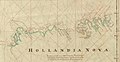
 AMH-5321-NA Map of Hollandia Nova.jpg 2,400 × 1,682; 661 KB
-
 MaartenVanDelftExeditieAustralieKaart.jpg 1,924 × 994; 343 KB
-