Category:1740s maps of Australia
States of Australia:
Internal territories of Australia:
External territories of Australia:
Internal territories of Australia:
External territories of Australia:
Media in category "1740s maps of Australia"
The following 9 files are in this category, out of 9 total.
-
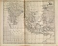 South Asia, 1744.jpg 6,453 × 5,161; 7.02 MB
-

-
 Amsterdam Royal Palace P1080013.JPG 4,000 × 3,000; 3.52 MB
-
 Australiane.jpg 800 × 600; 120 KB
-
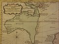
 Australianw.jpg 800 × 600; 130 KB
-
 Australiase.jpg 800 × 600; 107 KB
-
 Australiasw.jpg 800 × 600; 121 KB
-
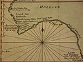
 Map of 'New Holland'(GN00279).jpg 3,264 × 2,448; 1.08 MB
-
 Map of Australia.jpg 800 × 600; 131 KB

.jpg)


.jpg)
