Category:1726 maps
| ← · 1720 · 1721 · 1722 · 1723 · 1724 · 1725 · 1726 · 1727 · 1728 · 1729 · → |
Deutsch: Karten mit Bezug zum Jahr 1726
English: Maps related to the year 1726
Español: Mapas relativos al año 1726
Français : Cartes concernant l’an 1726
Русский: Карты 1726 года
Subcategories
This category has the following 8 subcategories, out of 8 total.
Media in category "1726 maps"
The following 40 files are in this category, out of 40 total.
-

-

-
-

-

-
 AMH-2496-NA Plan of the old fortification A and the new fort B at Rio de la Goa.jpg 2,400 × 1,672; 584 KB
-
 AMH-2555-NA Map of the bay of Rio de Lagoa.jpg 2,008 × 2,400; 804 KB
-
 AMH-7259-KB Map of Bengal.jpg 2,400 × 1,997; 989 KB
-
 AMH-7260-KB Map of the Middle East.jpg 2,400 × 1,955; 1.16 MB
-
 AMH-7263-KB Maps of the city of Punto Gale and the fort of Manaar.jpg 1,433 × 2,400; 714 KB
-

-
 AMH-7268-KB Map of the Malabar coast.jpg 2,400 × 1,875; 980 KB
-
 Antoine Augustin Calmet, Carte de La Terre Promise (FL200036731 2368422).jpg 4,084 × 7,484; 46.15 MB
-
 Antoine Augustin Calmet, Carte pour les Actes des Apotres (FL200036705 2368423).jpg 6,072 × 4,080; 36.84 MB
-

-

-
 Antoine Augustin Calmet, Tabula Paradisi Terrestris (FL170208093 2368429).jpg 5,772 × 6,551; 38.79 MB
-
 Brobdingnag map.jpg 386 × 600; 35 KB
-

-
 Felibien & Lobineau, Plan de Paris, 1726 - Middlebury College.jpg 4,163 × 3,600; 6.53 MB
-
 Henri Michelot, Nouvelle carte generalle de la Mer Mediterranée 01-west (FL13730716 3368056).jpg 11,531 × 8,173; 138.6 MB
-
 Henri Michelot, Nouvelle carte generalle de la Mer Mediterranée 03-east (FL13730717 3368056).jpg 11,563 × 8,078; 140.32 MB
-
 Insulae Palaos seu Novae Philippinae 87, alias Archipelagus S. Lazari vel Carolinae.png 4,240 × 2,781; 20.82 MB
-
 Jacques-André Cobbé, Partie du Gange où sont les etablissements (FL35470342 2513529).jpg 17,315 × 12,936; 306.36 MB
-
 Kaart der Reyse van Abel Tasman volgens syn eygen opstel.png 5,596 × 3,634; 33.11 MB
-
 Karta över Kaspiska havet med omgivande länder, från 1726 - Skoklosters slott - 97955.tif 3,531 × 5,052; 51.05 MB
-
 Laputa map.gif 339 × 226; 3 KB
-
 Lugnagg.jpg 391 × 612; 39 KB
-
 Map of Houyhnhnms land.jpg 630 × 1,001; 113 KB
-
 Map of Lilliput - Gulliver's Travels 1726 edition.png 400 × 681; 187 KB
-

-
 Moll - The north part of Great Britain called Scotland.png 2,144 × 1,224; 3.6 MB
-
 1747 La Feuille Map of Holland - Geographicus - Holland-lafeuille-1747.jpg 3,000 × 1,932; 2.2 MB
-
 Plan des bois de Crepey (...) Hocquard (1726) gallica.jpg 3,680 × 2,080; 1.08 MB
-
 Tabula Indiae Orientalis et Regnorum adjacentium. LOC 2014588025.jpg 8,218 × 6,936; 10.68 MB
-
 Tabula Indiae Orientalis et Regnorum adjacentium. LOC 2014588025.tif 8,218 × 6,936; 163.08 MB
-
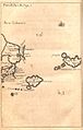
 Dutch-pescadores.png 989 × 656; 684 KB
-
 UBBasel Map 1726 VB A2-2-20.tif 4,797 × 4,927, 2 pages; 67.65 MB
-
 Viagens de Gulliver 009.jpg 384 × 600; 29 KB
-


.jpg)


.jpg)


.jpg)
.jpg)
.jpg)
.jpg)
.jpg)


.jpg)
.jpg)

.jpg)


_Hocquard_(1726)_gallica.jpg)


