Category:1750s maps of Lower Saxony
|
Federal states of Germany: |
Media in category "1750s maps of Lower Saxony"
The following 9 files are in this category, out of 9 total.
-
 Iter Mayerianum ad Musas Goettingenses A1.jpg 3,221 × 1,954; 2.73 MB
-
 Iter Mayerianum ad Musas Goettingenses.jpg 3,886 × 9,183; 8.38 MB
-
 Jacobus-Schuback-Commentarius-de-jure-littoris MG 0949.tif 4,644 × 3,551; 47.21 MB
-

-

-
 2021-03-29 Wendezeller Ring 02.JPG 1,563 × 2,344; 1.62 MB
-
 An accurate map of the northwest part of Germany... - by Eman. Bowen... - btv1b8468856b.jpg 4,378 × 6,036; 4.18 MB
-
 Hildesheim Plan 1750.jpg 1,048 × 1,275; 573 KB
-
 Stadtplan Celle 1754.jpg 8,443 × 5,984; 18.83 MB


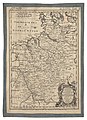
,_de_Mecklenbourg_et_des_%C3%A9v%C3%AAch%C3%A9s_d%27Hildesheim_et_d%27Halberstadt_-_par_le_Sr._Robert_-_btv1b53040584f.jpg)
.jpg)


