Category:1764 maps of Europe
Temperate regions: North America · South America · Africa · Europe · Asia · – Polar regions: – Other regions:
English: 1764 maps of Europe
Español: Mapas de Europa en 1764
Suomi: Euroopan kartat vuodelta 1764
Română: Hărți ale Europei din 1764
Subcategories
This category has the following 6 subcategories, out of 6 total.
Media in category "1764 maps of Europe"
The following 12 files are in this category, out of 12 total.
-
 Carte du Morbihan et la presqu'ile de Quiberon - Bellin - btv1b8591953b.jpg 5,773 × 3,901; 3.81 MB
-
 Jacques-Nicolas Bellin - Carte de l'Enclos de Lorient.jpg 873 × 1,162; 325 KB
-
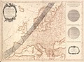
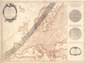
 L'Europe - dressée par le Sr Brion... - btv1b53093028f.jpg 8,672 × 6,640; 8.74 MB
-
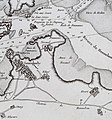 Locmiquélic Bellin 1764.jpg 1,132 × 1,211; 981 KB
-
-
-
 Plan de la ville de Nantes - Bellin - btv1b85919629.jpg 5,544 × 4,127; 4.16 MB
-
 Plan du Port et Ville de Cartagene en Espagne - btv1b53056367k.jpg 4,280 × 2,832; 1.88 MB
-
 Plano de la isla de alboran de 1764.png 1,803 × 828; 1.83 MB
-
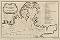
 Le petit atlas maritim 1764 (101587554).jpg 6,557 × 8,075; 8.56 MB
-
 Île d'Or. Jacques-Nicolas Bellin. 1764 - 2.jpg 540 × 720; 86 KB
-
 Île d'Or. Jacques-Nicolas Bellin. 1764.jpg 520 × 719; 70 KB


.jpg)

