Category:1760s maps of Europe
Temperate regions: North America · South America · Africa · Europe · Asia · Oceania – Polar regions: – Other regions:
Subcategories
This category has the following 48 subcategories, out of 48 total.
.
A
- 1760s maps of Austria (1 F)
B
- 1760s maps of Belgium (6 F)
- 1760s maps of Bosnia and Herzegovina (empty)
- 1760s maps of Bulgaria (empty)
C
- 1760s maps of Cyprus (1 F)
D
- 1760s maps of Denmark (4 F)
E
- 1760s maps of Eastern Europe (3 F)
F
G
- 1760s maps of Greece (3 F)
H
- 1760s maps of Hungary (2 F)
I
L
M
- 1760s maps of Moldova (1 F)
N
P
- 1760s maps of Portugal (18 F)
R
- 1760s maps of Romania (1 F)
- 1760s maps of Russia (4 F)
S
- 1760s maps of Sweden (3 F)
- 1760s maps of Switzerland (3 F)
T
- 1760s maps of Turkey (10 F)
U
- 1760s maps of Ukraine (12 F)
- 1760s maps of the United Kingdom (empty)
Media in category "1760s maps of Europe"
The following 5 files are in this category, out of 5 total.
-
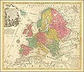 Europa Delineata juxta Observationes.jpg 14,539 × 12,306; 38.97 MB
-

-

-

-


..._-_auctor_d%27Anville_Regiae_Humaniorum_Litterarum_Academiae_et..._-_btv1b53119559w_(1_of_2).jpg)

..._(I%C3%A8re_%C3%A9dition)_-_auctor_d%27Anville_Regiae_Humaniorum_Litterarum..._-_btv1b53119617q_(1_of_2).jpg)
..._-_auctor_d%27Anville_Regiae_Humaniorum_Litterarum_Academiae_et_Scientarum..._-_btv1b530999763.jpg)