Category:1770s maps of China
Countries of Asia: Armenia‡ · Azerbaijan‡ · People's Republic of China · Cyprus‡ · Egypt‡ · Georgia‡ · India · Indonesia‡ · Iran · Iraq · Japan · Pakistan · Philippines · Russia‡ · Syria · Turkey‡ · Yemen
Limited recognition: Abkhazia‡ · Taiwan · State of Palestine
‡: partly located in Asia
Limited recognition: Abkhazia‡ · Taiwan · State of Palestine
‡: partly located in Asia
Media in category "1770s maps of China"
The following 13 files are in this category, out of 13 total.
-
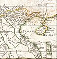
 1770 Bonne Map of China, Korea, Japan and Formosa - Geographicus - China-bonne-1770.jpg 4,000 × 2,787; 3.09 MB
-

-
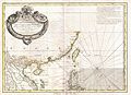
 1771 Bonne Map of Tonkin and Cochinchina (Vietnam).jpg 1,154 × 1,189; 436 KB
-
-
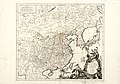
 Map - Special Collections University of Amsterdam - OTM- HB-KZL I 2 A 9 (31a).jpg 10,656 × 7,992; 27.07 MB
-

-

-

-
 1779 - Carte de l' Empire de la Chine avec la Tartarie Chinoise.jpg 7,144 × 5,918; 6.63 MB
-

-
 L'Empire de la Chine avec la Tartarie chinoise ; d'après l'atlas chinois. LOC 2006635530.jpg 11,680 × 8,183; 13.84 MB
-
 L'Empire de la Chine avec la Tartarie chinoise ; d'après l'atlas chinois. LOC 2006635530.tif 11,680 × 8,183; 273.45 MB
-


_-_Geographicus_-_TartarieChine-bonne-1770.jpg)
.jpg)
_China,_Formosa_(Taiwan)_and_Luzon_(Philippines)_-_Geographicus_-_Formosa-bonne-1771.jpg)
.jpg)


_Robert_de_Vaugondy_G%C3%A9ographe_ord(inaire)_du..._-_btv1b550137444_(124_of_183).jpg)


