Category:1780s maps of Iran
Countries of Asia: Afghanistan · Armenia‡ · Azerbaijan‡ · People's Republic of China · Cyprus‡ · Egypt‡ · Georgia‡ · India · Indonesia‡ · Iran · Iraq · Japan · Lebanon · Pakistan · Philippines · Russia‡ · Syria · Turkey‡ · Yemen
Limited recognition: Abkhazia‡ · Taiwan · State of Palestine
‡: partly located in Asia
Limited recognition: Abkhazia‡ · Taiwan · State of Palestine
‡: partly located in Asia
Subcategories
This category has only the following subcategory.
Media in category "1780s maps of Iran"
The following 7 files are in this category, out of 7 total.
-
 Rigobert-Bonne-Atlas-de-toutes-les-parties-connues-du-globe-terrestre MG 9999.tif 5,322 × 3,474; 52.93 MB
-
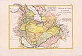
 Rigobert Bonne. Perse. 1787 (E).jpg 571 × 456; 102 KB
-
 Thomas Kitchin. Composite Asia, islands according to d'Anville. 1787 (A).jpg 1,207 × 1,077; 446 KB
-

-
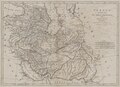
 Kingdoms of Persia and Georgia..jpg 2,542 × 1,806; 3.57 MB
-
 Persia, divided into its great provinces (NYPL b13919861-5207419).jpg 8,016 × 6,662; 44.2 MB
-
 Persia, divided into its great provinces (NYPL b13919861-5207419).tiff 6,405 × 4,629; 85.04 MB
.jpg)
.jpg)
.jpg)

.jpg)