Category:1780s maps of India
Countries of Asia: Afghanistan · Armenia‡ · Azerbaijan‡ · People's Republic of China · Cyprus‡ · Egypt‡ · Georgia‡ · India · Indonesia‡ · Iran · Iraq · Japan · Lebanon · Pakistan · Philippines · Russia‡ · Syria · Turkey‡ · Yemen
Limited recognition: Abkhazia‡ · Taiwan · State of Palestine
‡: partly located in Asia
Limited recognition: Abkhazia‡ · Taiwan · State of Palestine
‡: partly located in Asia
Subcategories
This category has the following 8 subcategories, out of 8 total.
- 1780 maps of India (11 F)
- 1782 maps of India (5 F)
- 1783 maps of India (2 F)
- 1784 maps of India (5 F)
- 1786 maps of India (1 F)
- 1789 maps of India (3 F)
A
- Maps of the Anglo-Mysore wars (15 F)
Media in category "1780s maps of India"
The following 14 files are in this category, out of 14 total.
-

-

-

-
 Gulf of Cambay From a map by Thomas Kitchin, 1782.jpg 800 × 593; 130 KB
-

-
 1785 map of India and Sri Lanka by Antonio Zatta.jpg 8,188 × 10,567; 13.41 MB
-
 Gulf of Cambay.jpg 750 × 576; 124 KB
-
 A Map of the East Indies (BM 1871,1209.112).jpg 2,500 × 2,105; 1.2 MB
-

-
 GoaIndiaeOrientalisMetropolis.jpg 2,751 × 2,048; 3.85 MB
-

-
 HyderAliDominions1780.jpg 848 × 1,131; 388 KB
-
 Rigobert-Bonne-Atlas-de-toutes-les-parties-connues-du-globe-terrestre MG 9993.tif 5,232 × 3,534; 52.93 MB
-
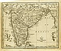
 The Peninsula of India, 1788.jpg 3,175 × 4,000; 1.99 MB

.jpg)

,_published_1783.jpg)


.jpg)


