Category:18th-century maps of India
Countries of Asia: Afghanistan · Armenia‡ · Azerbaijan‡ · Bangladesh · Cambodia · People's Republic of China · Cyprus‡ · Egypt‡ · Georgia‡ · India · Indonesia‡ · Iran · Iraq · Japan · Jordan · Lebanon · Malaysia · Mongolia · Myanmar · Pakistan · Philippines · Russia‡ · Singapore · Sri Lanka · Syria · Thailand · Turkey‡ · Turkmenistan · Uzbekistan · Vietnam · Yemen
Limited recognition: Abkhazia‡ · Taiwan · State of Palestine
‡: partly located in Asia
Limited recognition: Abkhazia‡ · Taiwan · State of Palestine
‡: partly located in Asia
Subcategories
This category has the following 10 subcategories, out of 10 total.
#
- 1710s maps of India (2 F)
- 1730s maps of India (9 F)
Media in category "18th-century maps of India"
The following 38 files are in this category, out of 38 total.
-
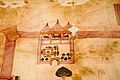
 Map of Ram Janmasthan at Ayodhya (1717 CE) cropped.png 624 × 415; 419 KB
-
 Map of Ram Mandir in Ayodhya at Jaipur City Palace.jpg 660 × 440; 28 KB
-
 The earliest map of Ram Janmasthan at Ayodhya (1717 CE).jpg 480 × 720; 249 KB
-
 Map of the southern part of India Schley, Jacobus van der Hondt, Pierre d'.jpg 1,920 × 1,800; 1.2 MB
-
 The Moguls Empire divided into its principal governments (BM 1875,0109.106).jpg 2,311 × 2,500; 1.24 MB
-

-

-
 A large chart of part of the coast of COREMANDELL from Point Pedro to Armegon NYPL1640643.tiff 7,230 × 5,428; 112.28 MB
-
 A large chart of part of the coast of GUZARATT and INDIA from Diu head to Bombay NYPL1640649.tiff 7,230 × 5,428; 112.28 MB
-
 A map of Hindoostan, or the Mogul Empire, 1788.jpg 4,000 × 3,412; 2.71 MB
-

-

-
 Africa Asia Persia India China Map in 1735 by Veith.jpg 800 × 600; 191 KB
-
 Carte de L'Inde 1752.jpg 3,911 × 3,372; 9.32 MB
-
 Catalogue of Historical Maps of Survey of India 1700-1900 by Prasad.pdf 1,131 × 1,579, 557 pages; 14.4 MB
-
 Charte von Ostindien nach I. Rennel. Gebrüder Lotter — between 1777 and 1810.jpg 1,637 × 2,000; 932 KB
-

-
 Imperii magni Mogolis sive Indici Padschach, juxta recentissimas navigationes LOC 2013593204.tif 6,956 × 6,058; 120.56 MB
-
 Inde L'Asie, India South Asia by Georges-Louis Le Rouge, France in 1767.jpg 1,600 × 1,200; 1,015 KB
-
 Inde South Asia Map in 1721 by Nicholas de Fer and J. Robbe.jpg 1,024 × 768; 167 KB
-
 India 1788.jpg 8,864 × 7,161; 46.72 MB
-
 India Map by Emanuel Bowen, London in 1754.jpg 1,500 × 1,195; 407 KB
-
 India, 1700 - 1792 From The Historical Atlas by William R. Shepherd, 1923.jpg 1,509 × 2,337; 574 KB
-
 Indostan - the kingdoms in South Asia by Nicolas de Fer 1721.jpg 720 × 600; 158 KB
-
 Kaart van de kust van Malabar en Cormandel (India) - AM - 71694.jpg 1,024 × 841; 191 KB
-
 Malabar1752sw.jpg 800 × 1,067; 167 KB
-

-
 Maratha Empire 1674 - 1818 ad.PNG 503 × 703; 10 KB
-
 Persia, Caspian Sea, part of Independent Tartary (Makeran).png 780 × 513; 659 KB
-
 Persia, Caspian Sea, part of Independent Tartary.png 2,163 × 1,991; 6.98 MB
-
 South Asia, India Map in 1730 by Matthaeus Seutter.jpg 1,247 × 1,064; 320 KB
-
 South India 1733.jpg 3,136 × 3,528; 12.81 MB
-
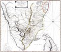 Southern India 1788.jpg 3,992 × 3,456; 14.56 MB
-
 Tabula Indiae Orientalis et Regnorum adjacentium. LOC 2014588025.jpg 8,218 × 6,936; 10.68 MB
-
 Tabula Indiae Orientalis et Regnorum adjacentium. LOC 2014588025.tif 8,218 × 6,936; 163.08 MB
-

-

-
 The Peninsula of India, 1788.jpg 3,175 × 4,000; 1.99 MB
_cropped.png)

.jpg)

.jpg)


.jpg)
.jpg)


_-_AM_-_71694.jpg)

.jpg)

.png)


