Category:18th-century maps of Armenia
Countries of Asia: Afghanistan · Armenia‡ · Azerbaijan‡ · Bangladesh · Cambodia · People's Republic of China · Cyprus‡ · Egypt‡ · Georgia‡ · India · Indonesia‡ · Iran · Iraq · Japan · Jordan · Lebanon · Malaysia · Mongolia · Myanmar · Pakistan · Philippines · Russia‡ · Singapore · Sri Lanka · Syria · Thailand · Turkey‡ · Turkmenistan · Uzbekistan · Vietnam · Yemen
Limited recognition: Abkhazia‡ · Taiwan · State of Palestine
‡: partly located in Asia
Limited recognition: Abkhazia‡ · Taiwan · State of Palestine
‡: partly located in Asia
Subcategories
This category has the following 9 subcategories, out of 9 total.
- 1700s maps of Armenia (empty)
- 1710s maps of Armenia (empty)
- 1720s maps of Armenia (5 F)
- 1740s maps of Armenia (4 F)
- 1760s maps of Armenia (1 F)
- 1770s maps of Armenia (1 F)
- 1780s maps of Armenia (10 F)
- 1790s maps of Armenia (4 F)
Media in category "18th-century maps of Armenia"
The following 9 files are in this category, out of 9 total.
-
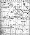
 "Turky in Asia" map circa 1790s.jpg 2,584 × 1,935; 964 KB
-

-
 D'Anville. Carte huilée de la Géorgie et de l'Arménie.XVIIIe siècle.jpg 5,440 × 4,012; 2.99 MB
-
 Map of Armenia during Middle Ages, 1736.jpg 1,200 × 1,423; 721 KB
-

-

-
 Persian and Ottoman Armenia. 1753 Vaugondy Map.jpg 1,264 × 560; 533 KB
-
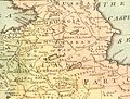 Safavid Persian Empire cropped - Caucasus.jpg 396 × 301; 59 KB
-
 Երնջակի գավառը Իգնատիոս Խաչատուրյանի քարտեզում.jpg 900 × 553; 598 KB

.jpg)


.E.jpg)
.I.jpg)


