Category:1780s maps of Venezuela
Media in category "1780s maps of Venezuela"
The following 13 files are in this category, out of 13 total.
-
 Rigobert-Bonne-Atlas-de-toutes-les-parties-connues-du-globe-terrestre MG 0018.tif 3,536 × 5,263; 53.28 MB
-
 Ar.j-t.8-c.2 61.jpg 10,630 × 7,489; 6.22 MB
-
-
 Croquis du cours inférieur de l'Orénoque - btv1b53122018s.jpg 3,892 × 1,350; 428 KB
-
 Map of Dutch Guiana and of Curaçao, Bonaire, and Aruba, 1781.jpg 4,980 × 3,976; 8.01 MB
-

-

-

-

-
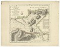
 Plano que comprehende desde Puerto Cavello hta. el de Turiamo LOC 90682966.jpg 8,654 × 6,269; 4.75 MB
-
 Plano que comprehende desde Puerto Cavello hta. el de Turiamo LOC 90682966.tif 8,654 × 6,269; 155.22 MB
-
 Rigobert-Bonne-Atlas-de-toutes-les-parties-connues-du-globe-terrestre MG 0008.tif 5,340 × 3,594; 54.94 MB
-
 Rigobert-Bonne-Atlas-de-toutes-les-parties-connues-du-globe-terrestre MG 0013.tif 5,263 × 3,618; 54.51 MB


