Category:1780s maps of the Atlantic Ocean
Media in category "1780s maps of the Atlantic Ocean"
The following 10 files are in this category, out of 10 total.
-

-
 1786-Benjamin-Franklin-Gulf-Stream-cropped.jpg 1,409 × 1,079; 304 KB
-
 Sjøkart over Nordatlanteren fra Island og Davisstredet og sørover til Frankrike, fra 1786.png 4,173 × 2,974; 27.84 MB
-
-
-
 2ndBritUSA.JPG 4,000 × 3,000; 6.1 MB
-

-
 A Chart of the Gulf Stream WDL20.png 1,648 × 1,024; 3.08 MB
-

-
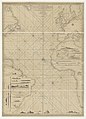
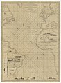
 A new general Chart of the Atlantic or western Ocean and adjacent seas... - btv1b53027605r.jpg 17,264 × 12,661; 30.29 MB


.jpg)
.jpg)

.jpg)


