Category:1790s maps of Florida
States of the United States: Alaska · Connecticut · Delaware · Florida · Georgia · Indiana · Kentucky · Louisiana · Maryland · Massachusetts · Missouri · New Hampshire · New Jersey · New York · North Carolina · Ohio · Pennsylvania · South Carolina · Tennessee · Vermont – Washington, D.C.
Puerto Rico
Puerto Rico
Media in category "1790s maps of Florida"
The following 5 files are in this category, out of 5 total.
-
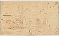
 Batería Isla Amelia.jpg 3,308 × 2,426; 864 KB
-
 Isla Amelia.jpg 3,386 × 2,077; 713 KB
-
 Rio de Santa María e Isla Amalia.jpg 2,914 × 4,167; 1.64 MB
-

-


.jpg)