Category:17th-century maps of Mecklenburg-Vorpommern
Federal states of Germany:
Subcategories
This category has the following 10 subcategories, out of 10 total.
Media in category "17th-century maps of Mecklenburg-Vorpommern"
The following 20 files are in this category, out of 20 total.
-

-
 Mecklenburg ducatus - auctore Ioanne Laurenbergio - btv1b53040879d (1 of 2).jpg 5,832 × 4,549; 4.69 MB
-
 Carte de Rügen (Eilhard Lubinus).jpg 4,176 × 3,228; 3.12 MB
-
 Eilhard Lubinus map of Pomerania - detail 1.png 1,600 × 1,200; 3.58 MB
-
 Eilhard Lubinus map of Pomerania - detail 2.png 1,600 × 1,200; 3.81 MB
-
 Eilhard Lubinus map of Pomerania - detail 3.png 1,600 × 1,200; 3.66 MB
-
 Eilhard Lubinus map of Pomerania - detail 4.png 1,600 × 1,200; 3.59 MB
-
 Eilhard Lubinus map of Pomerania.png 1,600 × 1,200; 3.32 MB
-
 Map - Special Collections University of Amsterdam - OTM- HB-KZL 31-25-01.tif 7,158 × 6,382; 130.7 MB
-
 Mecklenburg ducatus - auctore Ioanne Laurenbergio ; S. Rogiers sculp. - btv1b53040316p.jpg 6,139 × 5,162; 5.06 MB
-
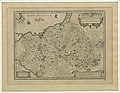
 Meklenburg Ducatus (Saxoniae Inferioris, Merian) b 002.jpg 3,809 × 3,019; 6.58 MB
-
 Meklenburg ducatus - auctore Ioanne Laurenbergio - btv1b55004538s.jpg 7,694 × 5,972; 4.55 MB
-
 Meklenburg ducatus - auctore Ioanne Laurenbergio - btv1b8443507q.jpg 8,900 × 7,179; 10.28 MB
-
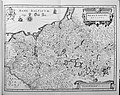
 Meklenburg ducatus - CBT 5874386.jpg 5,577 × 4,301; 5.17 MB
-

-
-
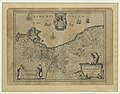
 Pomeraniae Ducatus Tabula2.jpg 4,101 × 3,180; 3.36 MB
-

-
 Rugia insula ac ducatus accuratissime - descripta ab E. Lubino... - btv1b84465104.jpg 8,232 × 6,264; 8.74 MB
-
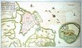 Stralsund 1678.JPG 1,348 × 783; 174 KB
.jpg)
.jpg)
.jpg)


_b_002.jpg)


.jpg)


