Category:17th-century maps of Saxony-Anhalt
Federal states of Germany:
Media in category "17th-century maps of Saxony-Anhalt"
The following 3 files are in this category, out of 3 total.
-
-
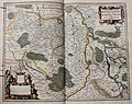
 "Saxonia superior & Hall Episcopatus" (22268899321).jpg 3,812 × 3,116; 2.41 MB
-
 Circulus Saxoniae superioris - CBT 5874744.jpg 5,646 × 4,749; 6.91 MB
.jpg)
.jpg)
