Category:1800 maps
| ← · 1800 · 1801 · 1802 · 1803 · 1804 · 1805 · 1806 · 1807 · 1808 · 1809 · → |
Deutsch: Karten mit Bezug zum Jahr 1800
English: Maps related to the year 1800
Español: Mapas relativos al año 1800
Français : Cartes concernant l’an 1800
Русский: Карты 1800 года
Subcategories
This category has the following 6 subcategories, out of 6 total.
Media in category "1800 maps"
The following 169 files are in this category, out of 169 total.
-
 't Eÿland Curacao, anno 1800 - (illegible). LOC 2001622484.jpg 6,590 × 4,368; 3.4 MB
-
 't Eÿland Curacao, ao. 1800. LOC 99465330.jpg 4,969 × 3,969; 2.97 MB
-
 (Chŏlla-do chido. LOC gm71005036.jpg 8,232 × 5,320; 4.32 MB
-
 (Chŏlla-do chido. LOC gm71005036.tif 8,232 × 5,320; 125.3 MB
-
 (Hamgyŏng-namdo, Hamgyŏng-pukto chŏndo). LOC 93684202.tif 10,359 × 14,093; 417.68 MB
-
 (Kyŏngsang-namdo, Kyŏngsang-pukto chŏndo). LOC 93684200.tif 7,098 × 9,930; 201.65 MB
-
 1800 Belgorod map Turkey in Europe and Hungary by Mathew Carey BPL 12328 detail.png 1,239 × 601; 1.21 MB
-
 1800 Northern and Southern Celestial Hemisphere maps.jpg 17,455 × 9,212; 36.88 MB
-

-

-
 A chart of the colony of Surinam, on the coast of Guyana. RMG K1121.jpg 1,148 × 1,280; 1.09 MB
-
 A chart of the colony of Surinam, on the coast of Guyana. RMG K1122.jpg 1,161 × 1,280; 1.12 MB
-
 A chart of the colony of Surinam, on the coast of Guyana. RMG K1123.jpg 1,183 × 1,280; 1.18 MB
-
 A chart of the colony of Surinam, on the coast of Guyana. RMG K1124.jpg 1,183 × 1,280; 1.02 MB
-
 A chart of the Gulf Stream inverted right to left (8475486331).jpg 800 × 610; 112 KB
-
 A chart of the West Indies, from the latest marine journals and surveys (3046155962).jpg 2,000 × 1,602; 2.87 MB
-

-
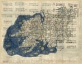
 A map of Ireland according to the best authorities (3045238263).jpg 3,890 × 4,343; 3.93 MB
-

-

-

-

-

-

-

-
 A new map of the world. LOC 85694393.jpg 7,656 × 3,149; 3.13 MB
-
 A new map of the world. LOC 85694393.tif 7,656 × 3,149; 68.98 MB
-
 A new plan of Egypt shewing the entrances to the Nile etc RMG L9139-001.jpg 1,280 × 888; 563 KB
-
 A sketch of the River Tagus from the Bar of Alcacova up to Coffin's Hole RMG F0026.tiff 6,833 × 5,360; 104.78 MB
-
 Aegypten und Canaan seit der (FL37110327 3886848).jpg 8,028 × 10,140; 105.05 MB
-
 Aegyptus et Cyrenaica (FL25570412 2512336).jpg 10,749 × 8,518; 113.33 MB
-
 Bankoku no zue (14006213687).jpg 2,500 × 1,678; 1.59 MB
-
 Boston map.jpg 1,560 × 2,400; 1.68 MB
-
 Brouillon du combat pres de Neubourg le 27 Juin 1800 RMG K1104.jpg 1,280 × 1,003; 1.06 MB
-

-

-

-

-

-

-

-

-

-
 Carte du monde de 1800.JPG 1,030 × 801; 217 KB
-
 Carte du Nord Est et du Nord West du pole (13993831662).jpg 2,500 × 1,527; 1.91 MB
-

-
 Carte Générale De L'Océan Atlantique ou Occidental (FL17237412 3239112).jpg 10,915 × 7,738; 119.05 MB
-
 Cheonhado. LOC 93684246.jpg 7,488 × 3,701; 4.78 MB
-
 Cheonhado. LOC 93684246.tif 7,488 × 3,701; 79.29 MB
-
 China-World Map Ming back.jpg 7,592 × 3,824; 4.91 MB
-
 China-World Map Ming front.jpg 7,488 × 3,701; 4.76 MB
-
 Chŏlla-namdo, Chŏlla-pukto chŏndo. LOC 93684199.jpg 6,932 × 9,814; 11.08 MB
-
 Chŏlla-namdo, Chŏlla-pukto chŏndo. LOC 93684199.tif 6,932 × 9,814; 194.64 MB
-
 Chʻungchʻŏng-namdo, Chʻungchʻŏng-pukto chŏndo. LOC 93684197.jpg 10,010 × 7,082; 10.75 MB
-
 Chʻungchʻŏng-namdo, Chʻungchʻŏng-pukto chŏndo. LOC 93684197.tif 10,010 × 7,082; 202.82 MB
-
 Conrad Buno, Palæstina et Phoenice cum parte coele Syriæ (FL37105282 3886735).jpg 4,579 × 4,218; 25.29 MB
-
 Das Koenigreich Jerusalem 1095-1291 (FL37110278 3886852).jpg 10,260 × 7,948; 111.07 MB
-
 Der Oesterreichische Kreis ohne die Vorlande 1800.jpg 18,326 × 14,041; 35.48 MB
-
 Diqiu quan tu = (map of the whole world) (9144038106).jpg 800 × 480; 108 KB
-
 Egypt, with part of Arabia and Palestine. LOC 99446219.jpg 5,957 × 8,382; 6.4 MB
-
 Egypt, with part of Arabia and Palestine. LOC 99446219.tif 5,957 × 8,382; 142.86 MB
-
 Ekonomisk karta över en del av en socken. Från 1800-talet - Skoklosters slott - 97971.tif 3,067 × 4,287; 37.63 MB
-
 Frogland, Georgetown D.C. & H. Balls lot, Viginia (sic). LOC 88693336.jpg 6,680 × 5,269; 3.52 MB
-
 Frogland, Georgetown D.C. & H. Balls lot, Viginia (sic). LOC 88693336.tif 6,680 × 5,269; 100.7 MB
-
 Galapagos islands RMG K1111.jpg 958 × 1,280; 957 KB
-

-
 Georgia, from the latest authorities (3045317979).jpg 2,000 × 1,504; 2.5 MB
-
 Giovanni Maria Cassini, Gli Imperi Antichi (FL147409316 2726897).jpg 3,753 × 4,963; 18.25 MB
-
 Giovanni Maria Cassini, Gli Imperi Antichi (FL147409370 2726905).jpg 3,753 × 5,064; 19.99 MB
-
 Guillaume Delisle, Carte de la Grece ou Turquie d'Europe (FL35072722 2534569).jpg 17,167 × 13,573; 328.52 MB
-
 Haiti 1800.jpg 2,000 × 1,533; 2.57 MB
-
 Hamgyŏng-namdo, Hamgyŏng-pukto chŏndo. LOC 93684202.jpg 10,359 × 14,093; 19.82 MB
-
 Hannover Calenberger Neustadt Linden Herrenhausen Stockdale 1800.jpg 6,703 × 4,972; 25.03 MB
-
 Hwanghae-namdo, Hwanghae-pukto chŏndo. LOC 93684198.jpg 7,941 × 6,209; 8.39 MB
-
 Hwanghae-namdo, Hwanghae-pukto chŏndo. LOC 93684198.tif 7,941 × 6,209; 141.06 MB
-
 Itinéraire du Caitaine Cook.JPG 813 × 824; 162 KB
-
 Jean Pierre Berthault, Vue Générale de Jérusalem (FL36381706 3888293).jpg 15,020 × 12,510; 291.53 MB
-

-
 Jilin tu. LOC 75690756.jpg 14,521 × 9,658; 13.97 MB
-
 Jilin tu. LOC 75690756.tif 14,521 × 9,658; 401.24 MB
-
 Johann Adam Philipp Stößel, Afrika (FL13728537 2511594).jpg 6,129 × 3,880; 32.15 MB
-
 John Stephenson, Gibraltar Bay (FL147556156 2471004).jpg 4,852 × 3,800; 16.53 MB
-
 John Stockdale, A Plan of Ratisbon (FL167448749 2370137).jpg 6,806 × 5,004; 40.52 MB
-
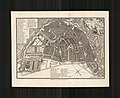 John Stockdale, A Plan of the City of Amsterdam (FL60504877 2370026).jpg 8,304 × 6,758; 69.13 MB
-
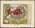
 John Stockdale, A plan of the city of Augsburg (FL167448388 2369922).jpg 7,067 × 5,498; 44.32 MB
-
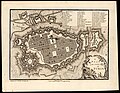
 John Stockdale, A plan of the city of Cassel (FL167448420 2369920).jpg 7,030 × 5,476; 50.84 MB
-
 John Stockdale, A plan of the city of Cologn (FL167448385 2369918).jpg 7,000 × 5,557; 44.92 MB
-
 John Stockdale, A Plan of the city of Dresden (FL167448415 2369924).jpg 7,028 × 5,497; 47.11 MB
-
 John Stockdale, A plan of the city of Geneva (FL167448624 2370132).jpg 7,124 × 5,701; 56.44 MB
-
 John Stockdale, A plan of the city of Genoa (FL167449051 2464039).jpg 6,976 × 5,301; 42.4 MB
-
 John Stockdale, A plan of the city of Hamburg (FL167448437 2369926).jpg 7,056 × 5,307; 44.73 MB
-
 John Stockdale, A Plan of the city of Hanover (FL167448378 2369921).jpg 7,027 × 5,278; 40.61 MB
-
 John Stockdale, A plan of the city of Malta (FL13722403 2471645).jpg 4,669 × 3,519; 23.23 MB
-
 John Stockdale, A plan of the city of Manheim (FL167448432 2369925).jpg 7,050 × 5,443; 46.37 MB
-
 John Stockdale, A plan of the city of Munich (FL167448350 2369919).jpg 7,021 × 5,336; 43.25 MB
-
 John Stockdale, A plan of the city of Naples (FL167449063 2464045).jpg 6,965 × 5,285; 44.65 MB
-
 John Stockdale, A Plan of the city of Paris (FL167448824 2370278).jpg 7,389 × 6,373; 60.83 MB
-
 John Stockdale, A plan of the city of Rome (FL167448982 2370318).jpg 7,344 × 6,580; 56.5 MB
-
 John Stockdale, A Plan of the city of Turin (FL167448834 2370283).jpg 7,054 × 5,463; 45.72 MB
-
 John Stockdale, A Plan of the city of Venice (FL167448812 2370279).jpg 6,951 × 5,467; 45.51 MB
-
 John Stockdale, A Plan of the city of Vienna (FL167448720 2370138).jpg 6,953 × 5,396; 45.33 MB
-
 John Stockdale, A plan of the city of Wurtzburg (FL167448408 2369923).jpg 6,989 × 5,463; 45.92 MB
-
 John Stockdale, Mantua and its environs (FL167448818 2370280).jpg 7,049 × 5,504; 44.09 MB
-
 Kangwŏn-do chido. LOC 93684201.jpg 9,271 × 9,780; 12.64 MB
-
 Kangwŏn-do chido. LOC 93684201.tif 9,271 × 9,780; 259.41 MB
-
 Kentucky, reduced from Elihu Barkers large map (3045318123).jpg 2,000 × 1,535; 2.6 MB
-

-
-
 Kyŏnggi-do chŏndo. LOC 93684194.jpg 7,324 × 5,818; 6.54 MB
-
 Kyŏnggi-do chŏndo. LOC 93684194.tif 7,324 × 5,818; 121.91 MB
-
 Kyŏngjo chŏndo. LOC gm71005218.jpg 4,992 × 4,316; 3.36 MB
-
 Kyŏngjo chŏndo. LOC gm71005218.tif 4,992 × 4,316; 61.64 MB
-
 Kyŏngjo obu. LOC gm71005217.jpg 5,016 × 4,336; 3.4 MB
-
 Kyŏngjo obu. LOC gm71005217.tif 5,016 × 4,336; 62.23 MB
-
 Kyŏngsang-namdo, Kyŏngsang-pukto chŏndo. LOC 93684200.jpg 7,098 × 9,930; 12.33 MB
-
 Lake Valdez (Now Lake Monroe) Florida 1826.jpg 1,404 × 837; 542 KB
-
 LECOQ SEELTERLOUND ENV.JPG 4,111 × 5,921; 6.22 MB
-
 LECOQ SEELTERLOUND.JPG 2,021 × 3,451; 1.73 MB
-
 LECOQ WANGEROOGE.JPG 3,510 × 2,550; 3.08 MB
-
 LECOQ WURSTEN.JPG 2,550 × 3,510; 3.06 MB
-
 Mannheim 1800 v Fr L Sckell.jpg 2,157 × 2,731; 3.53 MB
-
 Map depicting early land division and ownership in Barnard, Vermont (5961395356).jpg 1,432 × 2,000; 2.41 MB
-
 Map of Copenhagen 1800.jpg 5,000 × 3,519; 1.64 MB
-

-

-

-

-

-
 Middle East (FL13728996 2514697).jpg 6,093 × 8,059; 65.54 MB
-
 Nordenkart, 1800. Venstre side (12235023485).jpg 10,080 × 12,404; 29.47 MB
-
 Palaestina von der Eroberung Josua's bis zum (FL37110283 3886860).jpg 9,991 × 7,578; 101.24 MB
-
 Paris (FL167486064 3366590).jpg 3,390 × 4,915; 18.96 MB
-
 Pierre François Tardieu, Carte de la Turquie Asiatique (FL36010797 2716061).jpg 12,271 × 9,617; 169.49 MB
-
 Plan and view of Elsinore Road RMG K1102.jpg 871 × 1,280; 834 KB
-
 Plan and view of Elsinore Road RMG K1103.jpg 871 × 1,280; 805 KB
-
 Plan de la bataille du 3 Decembre 1800, entre Haag et Hohenlinden en Baviere RMG K1042.jpg 1,280 × 1,095; 1.53 MB
-
 Plan der Belagerung (FL35076528 2541054).jpg 13,100 × 10,641; 176.69 MB
-

-
 Plano geographico (FL39695819 3014962).jpg 4,744 × 7,305; 46.67 MB
-
 Planta da Praça de Peniche.jpg 3,812 × 2,935; 2 MB
-
 Plat of land lying between road to Benning's Bridge & Cool Spring Road. LOC 87694323.jpg 4,360 × 5,259; 2.09 MB
-
 Plat of land lying between road to Benning's Bridge & Cool Spring Road. LOC 87694323.tif 4,360 × 5,259; 65.6 MB
-

-
 Poland 1800.jpg 2,000 × 1,660; 3.22 MB
-
 Pʻyŏngan-namdo chŏndo. LOC 93684193.jpg 8,771 × 11,523; 17.07 MB
-
 Pʻyŏngan-namdo chŏndo. LOC 93684193.tif 8,771 × 11,523; 289.16 MB
-
 Railways in 1800, Great Britain. Wellcome L0002540.jpg 1,072 × 1,764; 344 KB
-
 Robert Wilkinson, Patriarchati Orientales (FL200036696 2369176).jpg 4,145 × 3,250; 19.07 MB
-
 Samuel John Neele, China (FL46961877 2557062).jpg 6,413 × 5,169; 46.11 MB
-
 Scotland with the principal roads from the best authorities (3045203079).jpg 1,802 × 2,000; 3.32 MB
-
 Sekai bankoku Nihon yori kaijō risū ōjō jinbutsuzu. LOC 88691685.jpg 5,655 × 4,179; 3.42 MB
-
 Sekai bankoku Nihon yori kaijō risū ōjō jinbutsuzu. LOC 88691685.tif 5,655 × 4,179; 67.61 MB
-
 Sibérie, Tartarie Chinoise et Isles du Japon (FL36380542 2607177).jpg 6,009 × 5,101; 45.73 MB
-
 Solovetskye ostrova 1800.jpg 6,198 × 5,666; 48.85 MB
-
 Switzerland according to the best authorities (3046076736).jpg 2,000 × 1,791; 2.73 MB
-
 The Austrian, French and Dutch Netherlands, from the best authorities (3046075558).jpg 2,000 × 1,485; 2.99 MB
-

-

-

-
 Tosŏng to. LOC 93684196.jpg 7,126 × 5,171; 6.05 MB
-
 Tosŏng to. LOC 93684196.tif 7,126 × 5,171; 105.42 MB
-
 Viceroyalty of the New Spain 1800 (without Philippines).png 1,600 × 1,192; 645 KB
-
 Vorstellung des Gelobten Landes (FL37110358 3886917).jpg 15,260 × 7,029; 146.33 MB
-
 Vue des Dardanelles (FL35285083 2714765).jpg 9,381 × 6,578; 89.02 MB
-
 Yamashiro no Kuni ezu. LOC 80691936.jpg 13,512 × 7,931; 12.53 MB
-
 Yamashiro no Kuni ezu. LOC 80691936.tif 13,512 × 7,931; 306.6 MB
-
 Zemljevid Štajerske leta 1800.jpg 9,046 × 7,518; 9.26 MB
-
 Zhongguo tu. LOC 2006458644.jpg 7,285 × 5,241; 5.85 MB
-
 Zhongguo tu. LOC 2006458644.tif 7,285 × 5,241; 109.24 MB
._LOC_2001622484.jpg)


.jpg)
.jpg)
.jpg)
.jpg)
.jpg)
.jpg)
.jpg)
.jpg)
.jpg)

.jpg)
.jpg)
.jpg)


_Al%C3%A1ntico_(sic)_que_comprehende_las_costas_de_Europa,_Africa_y_Am%C3%A9rica_septentrional_LOC_90680569.jpg)


.jpg)
.jpg)
.jpg)


.jpg)
.jpg)

_(9144038106).jpg)

._LOC_88693336.jpg)

.jpg)
.jpg)
.jpg)
.jpg)
.jpg)


.jpg)
.jpg)

.jpg)
.jpg)
.jpg)
.jpg)
.jpg)
.jpg)
.jpg)
.jpg)
.jpg)
.jpg)
.jpg)
.jpg)
.jpg)
.jpg)
.jpg)
.jpg)
.jpg)
.jpg)
.jpg)
.jpg)
.jpg)
.jpg)
.jpg)

.jpg)


_Florida_1826.jpg)


.jpg)


.jpg)
.jpg)
.jpg)
.jpg)
.jpg)
.jpg)


.jpg)

.jpg)


.jpg)


.jpg)
.jpg)
.jpg)

.jpg)

.jpg)
.jpg)
.jpg)
.jpg)
.jpg)

.png)
.jpg)
.jpg)


