Category:1803 maps
| ← · 1800 · 1801 · 1802 · 1803 · 1804 · 1805 · 1806 · 1807 · 1808 · 1809 · → |
Deutsch: Karten mit Bezug zum Jahr 1803
English: Maps related to the year 1803
Español: Mapas relativos al año 1803
Français : Cartes concernant l’an 1803
Русский: Карты 1803 года
Subcategories
This category has the following 7 subcategories, out of 7 total.
Media in category "1803 maps"
The following 40 files are in this category, out of 40 total.
-

-
 15 - Carta della Marca di Fermo, Roma 1803 - Bernardino Olivieri.jpg 2,812 × 2,235; 1.34 MB
-

-
 A new chart of the Azores or Western Isles (8250889280).jpg 2,000 × 1,620; 2.73 MB
-

-
 Carte atlantide.jpeg 3,664 × 3,743; 2.53 MB
-
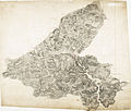
 Carte topographique du Tyrol-1.jpg 11,610 × 12,004; 60.67 MB
-
 Carte topographique du Tyrol-2.jpg 11,610 × 12,004; 59.48 MB
-
 Carte topographique du Tyrol-3.jpg 11,610 × 12,005; 58.46 MB
-
 Carte topographique du Tyrol-4.jpg 11,610 × 12,005; 53.89 MB
-
 Charles Paultre, Carte physique & politique de la Syrie (FL37251427 3375223).jpg 22,160 × 15,707; 477.01 MB
-

-
 Eratosthenes, Eratosthenis Werlds Karta (FL27971615 2725315).jpg 4,349 × 2,784; 16.12 MB
-
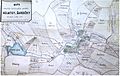
 Großer Stadtplan 1803.jpg 2,601 × 2,037; 906 KB
-
 Heathers New and Improved Chart of the Isles of Scilly (8249819881).jpg 2,000 × 1,622; 2.89 MB
-
 Jean-Baptiste Poirson, Carte réduite de la mer des Indes (FL27963693 2518805).jpg 13,330 × 10,375; 185.06 MB
-
 Johann Walch, Charte von Aegypten (FL25570073 2499972).jpg 5,203 × 6,234; 42.28 MB
-
 Kojatky-mapa 1785.jpg 813 × 517; 195 KB
-
 Lampedusa RMG F0435.tiff 7,205 × 5,566; 114.74 MB
-
 Lezoko mapa topografikoa.png 506 × 464; 426 KB
-
 Ordnance Survey Drawings - Bovey Tracey (OSD 37).jpg 4,000 × 3,062; 3.72 MB
-
 Ordnance Survey Drawings - Dartmoor, Devon (OSD 22).jpg 4,961 × 4,206; 4.25 MB
-

-

-

-
 Plan du cap et Mole S. Nicolas. LOC 2007627870.jpg 11,711 × 6,923; 8.21 MB
-
 Plan du cap et Mole S. Nicolas. LOC 2007627870.tif 11,711 × 6,923; 231.96 MB
-
 Plan du quartier juif de Plock en avril 1803.jpg 1,181 × 883; 657 KB
-

-
 Plan New Orleans 1803 Boquet de Woiseri Detail.jpg 1,024 × 312; 292 KB
-
 PlanNewOrleansBoquetadeWoiseri.jpg 430 × 644; 66 KB
-
 Plano da cidade do Rio de Janeiro elevado em 1791.jpg 4,277 × 2,774; 1.71 MB
-

-

-
 Plano do Rio Pará, elaborado por Joze Fernandes Portugal em 1803..jpg 2,027 × 2,424; 2.48 MB
-
 Salzwasserleitung von Reichenhall nach Traunstein (1803).jpg 1,570 × 2,699; 1.36 MB
-

-

-
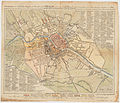 Sotzmann Grundriss der Königlichen Haupt und Residenzstadt Berlin 1803.jpg 5,485 × 4,693; 12.16 MB
-
 Survey of Upper Louisiana District of St. Louis of Illinois, 1803.jpg 8,768 × 5,400; 9.03 MB

_(14598126759).jpg)
.jpg)


.jpg)

.jpg)

.jpg)
.jpg)
.jpg)


.jpg)
.jpg)


.jpg)


.jpg)
_in_Mr._Rudulph%27s_swamp_-_(Chesapeake_and_Delaware_Canal,_Maryland_portion)_LOC_2001621324.jpg)

