Category:1810s maps of Iran
Countries of Asia: Afghanistan · Armenia‡ · Azerbaijan‡ · People's Republic of China · Cyprus‡ · Egypt‡ · Georgia‡ · India · Indonesia‡ · Iran · Iraq · Japan · Lebanon · Pakistan · Philippines · Russia‡ · Syria · Turkey‡ · Turkmenistan
Limited recognition: Abkhazia‡ · Taiwan · State of Palestine
‡: partly located in Asia
Limited recognition: Abkhazia‡ · Taiwan · State of Palestine
‡: partly located in Asia
Subcategories
This category has the following 3 subcategories, out of 3 total.
- 1812 maps of Iran (3 F)
- 1815 maps of Iran (2 F)
- 1818 maps of Iran (4 F)
Media in category "1810s maps of Iran"
The following 10 files are in this category, out of 10 total.
-
 Bowen, Frances. Turkey in Asia. 1810 (M).jpg 853 × 807; 86 KB
-
 Carte de la Perse, de la Turquie d'Asie et d'une partie de la Tartarie Indépendante.jpg 9,844 × 6,492; 13.78 MB
-
-

-
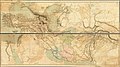
 Northwest Persia1811.jpg 1,880 × 1,508; 1.16 MB
-
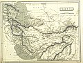
 Persia1814.jpg 1,282 × 995; 503 KB
-
 Outlines of the Countries Between Delhi and Constantinople By A. Arrowsmith 1814. Additions to 1816.jpg 51,566 × 29,000; 367.93 MB
-
 Northwestern and western Iran according to a 19th-century map by John Thomson.jpg 2,068 × 4,714; 2.05 MB
-
 John Pinkerton. Map of Persia. 1818.G. Aderbijan.jpg 615 × 736; 170 KB
-
 John Pinkerton. Map of Persia. 1818.H. Ghilan.jpg 627 × 605; 127 KB
.jpg)

.jpg)
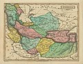
_-_Geographicus_-_Persia-pinkerton-1811.jpg)


